Linyi geodata
Linyi (Shandong) is a populated place; located in China in Asia/Shanghai (GMT+8) time zone. With population of 270,669 people, there are 186 cities with bigger population in this country. Compared to other cities in China, 75.2% of cities are located further ↓South; 72.2% of cities are located further ←West and 65.8% of cities have higher elevation than Linyi. Note1


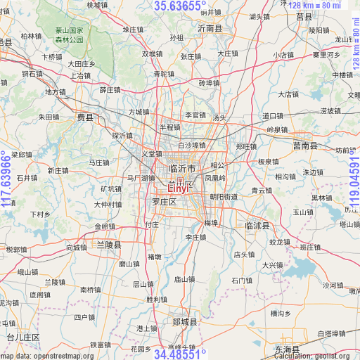
Linyi GPS coordinates[2]
35° 3' 47.016" North, 118° 20' 34.008" East
| Map corner | latitude | longitude |
|---|---|---|
| Upper-left | 35.63655°, | 117.63966° |
| Center: | 35.06306°, | 118.34278° |
| Lower-right: | 34.48551°, | 119.04591° |
| Map W x H: | 128×128 km | = 79.5×79.5mi |
| max Lat: | 53.31946° ⇑24.8% North |
| Linyi: | 35.06306° |
| min Lat: | ⇓75.2% South 18.22056° |
| min Long | Linyi | max Long |
| 75.07348° | 118.34278° | 134.28917° |
| W 72.2%⇐ | ⇒27.8% E |
Elevation
Elevation of Linyi is 69 m = 226 ft, and this is 415.8 m = 1364 ft below average elevation for this country.
| Max E: |
5622 m = 18445 ft | 65.8% |
| Avg. | 484.8 m = 1591 ft | |
| Linyi | 69 m = 226 ft | |
Min E: |
-3 m = -10 ft | 34.2% |
See also: Linyi elevation on elevation.city.
Geographical zone
Linyi is located in North temperate zone (between Tropic of Cancer and the Arctic Circle). Distance of this Northern Tropic circle is 1292.7 km =803.2 mi to South.| Distance of | km | miles | from Linyi |
|---|---|---|---|
| North Pole | 6108.4 | 3795.6 | to North |
| Arctic Circle | 3502.5 | 2176.4 | to North |
| Tropic Cancer | 1292.7 | 803.2 | to South |
| Equator | 3898.6 | 2422.5 | to South |


Nearby cities:
15 places around Linyi: (largest is in red/bold)
• Bianzhuang
36.1 km =22.4 mi,  228°
228°
• Chengyang
72.6 km =45.1 mi,  37°
37°
• Dunshang
74.7 km =46.4 mi,  121°
121°
• Feicheng
40.6 km =25.2 mi,  302°
302°
• Haitou
76.7 km =47.7 mi,  100°
100°
• Jiehu
54.3 km =33.7 mi,  10°
10°
• Luoyang
80 km =49.7 mi, 119°
• Niushan
71.3 km =44.3 mi,  147°
147°
• Qingkou
73.7 km =45.8 mi,  108°
108°
• Shanting
80.5 km =50 mi,  270°
270°
• Shizilu
45.8 km =28.5 mi,  74°
74°
• Songzhuang
79.1 km =49.2 mi, 113°
• Tancheng
49.8 km =30.9 mi,  180°
180°
• Xiazhuang
31.5 km =19.6 mi, 121°
• Zaozhuang
75.2 km =46.7 mi,  252°
252°
Sources, notices
• [Note1] Compared only with cities in China existing in our database
• [Src1] Map data: © OpenStreetMap contributors (CC-BY-SA)
• [Src2] Other city data from geonames.org with taken over terms of usage.
• [Src3] Geographical zone / Annual Mean Temperature by Robert A. Rohde @ Wikipedia
