Silihe geodata
Silihe (Hunan) is a seat of a fourth-order administrative division; located in China in Asia/Shanghai (GMT+8) time zone. In our database, there are 1268 cities with bigger population. Compared to other cities in China, 70.5% of cities are located further ↑North; 63.4% of cities are located further →East and 57.1% of cities have higher elevation than Silihe. Note1


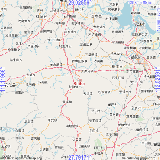
Silihe GPS coordinates[2]
28° 24' 42.984" North, 111° 49' 22.008" East
| Map corner | latitude | longitude |
|---|---|---|
| Upper-left | 29.02856°, | 111.11966° |
| Center: | 28.41194°, | 111.82278° |
| Lower-right: | 27.79171°, | 112.52591° |
| Map W x H: | 137.5×137.5 km | = 85.4×85.4mi |
| max Lat: | 53.31946° ⇑70.5% North |
| Silihe: | 28.41194° |
| min Lat: | ⇓29.5% South 18.22056° |
| min Long | Silihe | max Long |
| 75.07348° | 111.82278° | 134.28917° |
| W 36.6%⇐ | ⇒63.4% E |
Elevation
Elevation of Silihe is 117 m = 384 ft, and this is 367.8 m = 1207 ft below average elevation for this country.
| Max E: |
5622 m = 18445 ft | 57.1% |
| Avg. | 484.8 m = 1591 ft | |
| Silihe | 117 m = 384 ft | |
Min E: |
-3 m = -10 ft | 42.9% |
See also: China elevation on elevation.city.
Geographical zone
Silihe is located in North temperate zone (between Tropic of Cancer and the Arctic Circle). Distance of this Northern Tropic circle is 553.2 km =343.7 mi to South.| Distance of | km | miles | from Silihe |
|---|---|---|---|
| North Pole | 6848 | 4255.1 | to North |
| Arctic Circle | 4242.1 | 2635.9 | to North |
| Tropic Cancer | 553.2 | 343.7 | to South |
| Equator | 3159.1 | 1963 | to South |


Nearby cities:
15 places around Silihe: (largest is in red/bold)
• Changtang
7.8 km =4.8 mi,  218°
218°
• Cuijiaqiao
36.4 km =22.6 mi,  28°
28°
• Cuiping
33.1 km =20.6 mi,  125°
125°
• Huangtudian
38.2 km =23.7 mi,  338°
338°
• Luojiaping
21.5 km =13.4 mi,  349°
349°
• Qianjiaping
30 km =18.6 mi, 337°
• Shiniujiang
33 km =20.5 mi,  85°
85°
• Songmutang
27.4 km =17 mi,  112°
112°
• Taohuajiang
32.1 km =19.9 mi,  67°
67°
• Wuqishan
27.7 km =17.2 mi,  24°
24°
• Wutan
13.6 km =8.5 mi,  331°
331°
• Xiangzikou
36.7 km =22.8 mi,  159°
159°
• Xianxi
21.9 km =13.6 mi,  211°
211°
• Xiushan
29 km =18 mi,  45°
45°
• Yangjiaotang
24 km =14.9 mi,  304°
304°
Sources, notices
• [Note1] Compared only with cities in China existing in our database
• [Src1] Map data: © OpenStreetMap contributors (CC-BY-SA)
• [Src2] Other city data from geonames.org with taken over terms of usage.
• [Src3] Geographical zone / Annual Mean Temperature by Robert A. Rohde @ Wikipedia
