Shima geodata
Shima (Sichuan) is a populated place; located in China in Asia/Shanghai (GMT+8) time zone. With population of 1,000 people, there are 1171 cities with bigger population in this country. Compared to other cities in China, 61.2% of cities are located further ↓South; 85.4% of cities are located further →East and 79.9% of cities have lower elevation than Shima. Note1


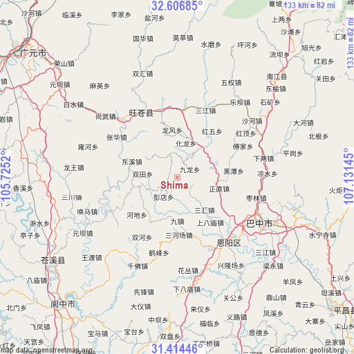
Shima GPS coordinates[2]
32° 0' 45.324" North, 106° 25' 41.952" East
| Map corner | latitude | longitude |
|---|---|---|
| Upper-left | 32.60685°, | 105.7252° |
| Center: | 32.01259°, | 106.42832° |
| Lower-right: | 31.41446°, | 107.13145° |
| Map W x H: | 132.6×132.6 km | = 82.4×82.4mi |
| max Lat: | 53.31946° ⇑38.8% North |
| Shima: | 32.01259° |
| min Lat: | ⇓61.2% South 18.22056° |
| min Long | Shima | max Long |
| 75.07348° | 106.42832° | 134.28917° |
| W 14.6%⇐ | ⇒85.4% E |
Elevation
Elevation of Shima is 689 m = 2260 ft, and this is 204.2 m = 670 ft above average elevation for this country.
| Max E: |
5622 m = 18445 ft | 20.1% |
| Shima | 689 m 2260 ft | |
| Avg. | 484.8 m = 1591 ft | |
Min E: |
-3 m = -10 ft | 79.9% |
See also: China elevation on elevation.city.
Geographical zone
Shima is located in North temperate zone (between Tropic of Cancer and the Arctic Circle). Distance of this Northern Tropic circle is 953.5 km =592.5 mi to South.| Distance of | km | miles | from Shima |
|---|---|---|---|
| North Pole | 6447.6 | 4006.4 | to North |
| Arctic Circle | 3841.7 | 2387.1 | to North |
| Tropic Cancer | 953.5 | 592.5 | to South |
| Equator | 3559.5 | 2211.8 | to South |


Nearby cities:
15 places around Shima: (largest is in red/bold)
• Changchi
27.4 km =17 mi,  52°
52°
• Donghe
27.3 km =17 mi,  334°
334°
• Dongxi
18 km =11.2 mi,  289°
289°
• Fujia
27.3 km =17 mi,  64°
64°
• Gaopo
12.2 km =7.6 mi,  315°
315°
• Heitan
21.3 km =13.2 mi,  83°
83°
• Heping
12.7 km =7.9 mi,  72°
72°
• Hualong
13.4 km =8.3 mi,  13°
13°
• Huangmao
9.3 km =5.8 mi,  341°
341°
• Huangyang
25.8 km =16 mi,  347°
347°
• Longfeng
17.8 km =11.1 mi, 352°
• Mumen
14.2 km =8.8 mi,  40°
40°
• Puji
25.3 km =15.7 mi, 5°
• Sanjiang
27.2 km =16.9 mi,  22°
22°
• Zhanghua
27.4 km =17 mi,  303°
303°
Sources, notices
• [Note1] Compared only with cities in China existing in our database
• [Src1] Map data: © OpenStreetMap contributors (CC-BY-SA)
• [Src2] Other city data from geonames.org with taken over terms of usage.
• [Src3] Geographical zone / Annual Mean Temperature by Robert A. Rohde @ Wikipedia
