Shanhe geodata
Shanhe (Gansu) is a seat of a third-order administrative division; located in China in Asia/Shanghai (GMT+8) time zone. In our database, there are 1268 cities with bigger population. Compared to other cities in China, 75.9% of cities are located further ↓South; 79.1% of cities are located further →East and 90% of cities have lower elevation than Shanhe. Note1


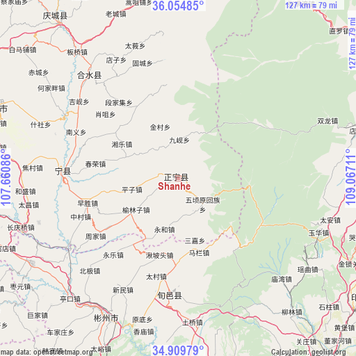
Shanhe GPS coordinates[2]
35° 29' 3.696" North, 108° 21' 50.328" East
| Map corner | latitude | longitude |
|---|---|---|
| Upper-left | 36.05485°, | 107.66086° |
| Center: | 35.48436°, | 108.36398° |
| Lower-right: | 34.90979°, | 109.06711° |
| Map W x H: | 127.3×127.3 km | = 79.1×79.1mi |
| max Lat: | 53.31946° ⇑24.1% North |
| Shanhe: | 35.48436° |
| min Lat: | ⇓75.9% South 18.22056° |
| min Long | Shanhe | max Long |
| 75.07348° | 108.36398° | 134.28917° |
| W 20.9%⇐ | ⇒79.1% E |
Elevation
Elevation of Shanhe is 1358 m = 4455 ft, and this is 873.2 m = 2865 ft above average elevation for this country.
| Max E: |
5622 m = 18445 ft | 10% |
| Shanhe | 1358 m 4455 ft | |
| Avg. | 484.8 m = 1591 ft | |
Min E: |
-3 m = -10 ft | 90% |
See also: China elevation on elevation.city.
Geographical zone
Shanhe is located in North temperate zone (between Tropic of Cancer and the Arctic Circle). Distance of this Northern Tropic circle is 1339.6 km =832.4 mi to South.| Distance of | km | miles | from Shanhe |
|---|---|---|---|
| North Pole | 6061.6 | 3766.5 | to North |
| Arctic Circle | 3455.7 | 2147.3 | to North |
| Tropic Cancer | 1339.6 | 832.4 | to South |
| Equator | 3945.5 | 2451.6 | to South |


Nearby cities:
15 places around Shanhe: (largest is in red/bold)
• Bojia
63.5 km =39.5 mi,  167°
167°
• Guanzhuang
65.2 km =40.5 mi,  176°
176°
• Hujiamiao
58.7 km =36.5 mi, 175°
• Longgao
59 km =36.7 mi, 184°
• Qinhe
66.1 km =41.1 mi,  161°
161°
• Shiliyuan
66.1 km =41.1 mi, 171°
• Shuikou
66 km =41 mi,  210°
210°
• Taiyu
67.3 km =41.8 mi,  204°
204°
• Tiewang
65.9 km =40.9 mi, 163°
• Xiangmiao
56.1 km =34.9 mi,  192°
192°
• Xihuachi
48.7 km =30.3 mi,  319°
319°
• Xinbuzi
60.9 km =37.8 mi, 204°
• Xinning
40.2 km =25 mi,  271°
271°
• Xunyi Chengguanzhen
41.1 km =25.5 mi, 186°
• Zhaoren
60.4 km =37.5 mi,  239°
239°
Sources, notices
• [Note1] Compared only with cities in China existing in our database
• [Src1] Map data: © OpenStreetMap contributors (CC-BY-SA)
• [Src2] Other city data from geonames.org with taken over terms of usage.
• [Src3] Geographical zone / Annual Mean Temperature by Robert A. Rohde @ Wikipedia
