Shadaoguan geodata
Shadaoguan (Hubei) is a seat of a fourth-order administrative division; located in China in Asia/Shanghai (GMT+8) time zone. In our database, there are 1268 cities with bigger population. Compared to other cities in China, 52.4% of cities are located further ↑North; 63.1% of cities are located further →East and 71.6% of cities have higher elevation than Shadaoguan. Note1


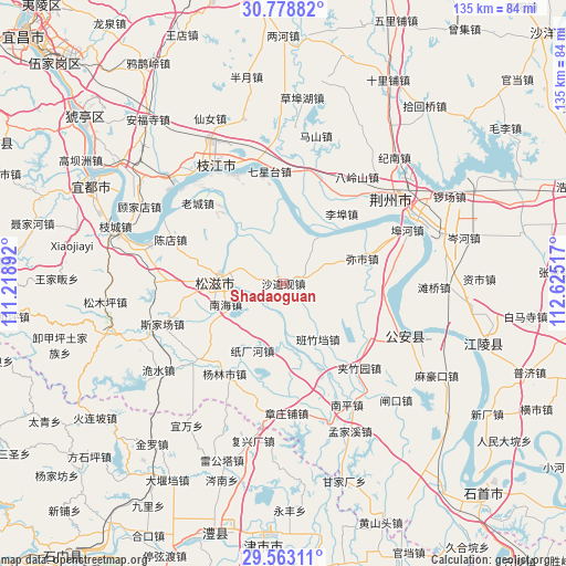
Shadaoguan GPS coordinates[2]
30° 10' 22.224" North, 111° 55' 19.344" East
| Map corner | latitude | longitude |
|---|---|---|
| Upper-left | 30.77882°, | 111.21892° |
| Center: | 30.17284°, | 111.92204° |
| Lower-right: | 29.56311°, | 112.62517° |
| Map W x H: | 135.2×135.2 km | = 84×84mi |
| max Lat: | 53.31946° ⇑52.4% North |
| Shadaoguan: | 30.17284° |
| min Lat: | ⇓47.6% South 18.22056° |
| min Long | Shadaoguan | max Long |
| 75.07348° | 111.92204° | 134.28917° |
| W 36.9%⇐ | ⇒63.1% E |
Elevation
Elevation of Shadaoguan is 46 m = 151 ft, and this is 438.8 m = 1440 ft below average elevation for this country.
| Max E: |
5622 m = 18445 ft | 71.6% |
| Avg. | 484.8 m = 1591 ft | |
| Shadaoguan | 46 m = 151 ft | |
Min E: |
-3 m = -10 ft | 28.4% |
See also: China elevation on elevation.city.
Geographical zone
Shadaoguan is located in North temperate zone (between Tropic of Cancer and the Arctic Circle). Distance of this Northern Tropic circle is 749 km =465.4 mi to South.| Distance of | km | miles | from Shadaoguan |
|---|---|---|---|
| North Pole | 6652.2 | 4133.5 | to North |
| Arctic Circle | 4046.3 | 2514.3 | to North |
| Tropic Cancer | 749 | 465.4 | to South |
| Equator | 3354.9 | 2084.6 | to South |


Nearby cities:
15 places around Shadaoguan: (largest is in red/bold)
• Babao
5.1 km =3.2 mi,  281°
281°
• Bailizhou
28.4 km =17.6 mi,  335°
335°
• Banzhudang
15.7 km =9.8 mi,  148°
148°
• Jiazhuyuan
27.1 km =16.8 mi,  138°
138°
• Jieheshi
26.7 km =16.6 mi,  228°
228°
• Laocheng
28 km =17.4 mi,  313°
313°
• Libu
21.7 km =13.5 mi,  39°
39°
• Maojiagang
20.1 km =12.5 mi, 135°
• Mishi
19.8 km =12.3 mi,  72°
72°
• Nanhai
14.7 km =9.1 mi,  250°
250°
• Qixingtai
27 km =16.8 mi,  352°
352°
• Shizikou
22.4 km =13.9 mi,  157°
157°
• Wangjiaqiao
24.5 km =15.2 mi,  260°
260°
• Yanglinshi
25.8 km =16 mi,  213°
213°
• Zhichanghe
17.7 km =11 mi,  204°
204°
Sources, notices
• [Note1] Compared only with cities in China existing in our database
• [Src1] Map data: © OpenStreetMap contributors (CC-BY-SA)
• [Src2] Other city data from geonames.org with taken over terms of usage.
• [Src3] Geographical zone / Annual Mean Temperature by Robert A. Rohde @ Wikipedia
