Bailizhou geodata
Bailizhou (Hubei) is a seat of a fourth-order administrative division; located in China in Asia/Shanghai (GMT+8) time zone. In our database, there are 1268 cities with bigger population. Compared to other cities in China, 50.4% of cities are located further ↑North; 63.5% of cities are located further →East and 71.9% of cities have higher elevation than Bailizhou. Note1


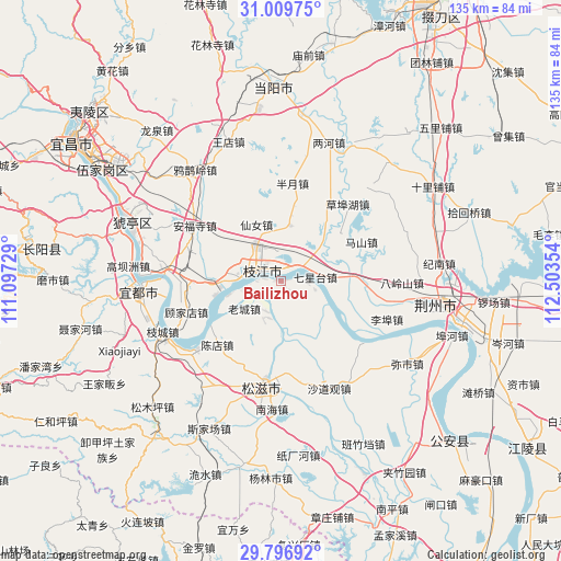
Bailizhou GPS coordinates[2]
30° 24' 18.792" North, 111° 48' 1.476" East
| Map corner | latitude | longitude |
|---|---|---|
| Upper-left | 31.00975°, | 111.09729° |
| Center: | 30.40522°, | 111.80041° |
| Lower-right: | 29.79692°, | 112.50354° |
| Map W x H: | 134.9×134.9 km | = 83.8×83.8mi |
| max Lat: | 53.31946° ⇑50.4% North |
| Bailizhou: | 30.40522° |
| min Lat: | ⇓49.6% South 18.22056° |
| min Long | Bailizhou | max Long |
| 75.07348° | 111.80041° | 134.28917° |
| W 36.5%⇐ | ⇒63.5% E |
Elevation
Elevation of Bailizhou is 45 m = 148 ft, and this is 439.8 m = 1443 ft below average elevation for this country.
| Max E: |
5622 m = 18445 ft | 71.9% |
| Avg. | 484.8 m = 1591 ft | |
| Bailizhou | 45 m = 148 ft | |
Min E: |
-3 m = -10 ft | 28.1% |
See also: China elevation on elevation.city.
Geographical zone
Bailizhou is located in North temperate zone (between Tropic of Cancer and the Arctic Circle). Distance of this Northern Tropic circle is 774.8 km =481.4 mi to South.| Distance of | km | miles | from Bailizhou |
|---|---|---|---|
| North Pole | 6626.3 | 4117.4 | to North |
| Arctic Circle | 4020.4 | 2498.2 | to North |
| Tropic Cancer | 774.8 | 481.4 | to South |
| Equator | 3380.7 | 2100.7 | to South |


Nearby cities:
15 places around Bailizhou: (largest is in red/bold)
• Anfusi
24.5 km =15.2 mi,  302°
302°
• Babao
25.7 km =16 mi,  164°
164°
• Baiyang
28 km =17.4 mi,  273°
273°
• Banyue
23.7 km =14.7 mi,  6°
6°
• Chendian
21.6 km =13.4 mi,  224°
224°
• Dongshi
9.3 km =5.8 mi, 272°
• Gujiadian
23 km =14.3 mi,  248°
248°
• Laocheng
11 km =6.8 mi,  232°
232°
• Libu
27.2 km =16.9 mi,  109°
109°
• Nanhai
30.9 km =19.2 mi,  183°
183°
• Qixingtai
8.4 km =5.2 mi,  83°
83°
• Shadaoguan
28.4 km =17.6 mi, 155°
• Wen’an
13.4 km =8.3 mi, 9°
• Xiannü
14.7 km =9.1 mi,  336°
336°
• Zhijiang
4.9 km =3 mi,  291°
291°
Sources, notices
• [Note1] Compared only with cities in China existing in our database
• [Src1] Map data: © OpenStreetMap contributors (CC-BY-SA)
• [Src2] Other city data from geonames.org with taken over terms of usage.
• [Src3] Geographical zone / Annual Mean Temperature by Robert A. Rohde @ Wikipedia
