Sandu geodata
Sandu (Zhejiang) is a seat of a fourth-order administrative division; located in China in Asia/Shanghai (GMT+8) time zone. In our database, there are 1268 cities with bigger population. Compared to other cities in China, 59.3% of cities are located further ↑North; 79.3% of cities are located further ←West and 74.8% of cities have higher elevation than Sandu. Note1


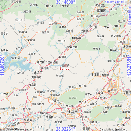
Sandu GPS coordinates[2]
29° 32' 10.32" North, 119° 34' 13.368" East
| Map corner | latitude | longitude |
|---|---|---|
| Upper-left | 30.14609°, | 118.86726° |
| Center: | 29.5362°, | 119.57038° |
| Lower-right: | 28.92261°, | 120.27351° |
| Map W x H: | 136×136 km | = 84.5×84.5mi |
| max Lat: | 53.31946° ⇑59.3% North |
| Sandu: | 29.5362° |
| min Lat: | ⇓40.7% South 18.22056° |
| min Long | Sandu | max Long |
| 75.07348° | 119.57038° | 134.28917° |
| W 79.3%⇐ | ⇒20.7% E |
Elevation
Elevation of Sandu is 37 m = 121 ft, and this is 447.8 m = 1469 ft below average elevation for this country.
| Max E: |
5622 m = 18445 ft | 74.8% |
| Avg. | 484.8 m = 1591 ft | |
| Sandu | 37 m = 121 ft | |
Min E: |
-3 m = -10 ft | 25.2% |
See also: China elevation on elevation.city.
Geographical zone
Sandu is located in North temperate zone (between Tropic of Cancer and the Arctic Circle). Distance of this Northern Tropic circle is 678.2 km =421.4 mi to South.| Distance of | km | miles | from Sandu |
|---|---|---|---|
| North Pole | 6722.9 | 4177.4 | to North |
| Arctic Circle | 4117.1 | 2558.2 | to North |
| Tropic Cancer | 678.2 | 421.4 | to South |
| Equator | 3284.1 | 2040.6 | to South |


Nearby cities:
15 places around Sandu: (largest is in red/bold)
• Baisha
29.7 km =18.5 mi,  149°
149°
• Baishe
23.2 km =14.4 mi,  160°
160°
• Dayang
12 km =7.5 mi,  209°
209°
• Duntou
27.2 km =16.9 mi,  139°
139°
• Eshan
29.4 km =18.3 mi,  0°
0°
• Fuchunjiang
20.9 km =13 mi,  20°
20°
• Meicheng
6.9 km =4.3 mi,  276°
276°
• Meijiang
29.9 km =18.6 mi,  129°
129°
• Qiantan
9.8 km =6.1 mi,  341°
341°
• Qintang
19.9 km =12.4 mi,  358°
358°
• Xiabao
18.7 km =11.6 mi, 335°
• Xiachen
18.2 km =11.3 mi, 140°
• Xiangxi
27.9 km =17.3 mi,  187°
187°
• Xin’anjiang
29.7 km =18.5 mi,  256°
256°
• Yuzhai
29 km =18 mi,  83°
83°
Sources, notices
• [Note1] Compared only with cities in China existing in our database
• [Src1] Map data: © OpenStreetMap contributors (CC-BY-SA)
• [Src2] Other city data from geonames.org with taken over terms of usage.
• [Src3] Geographical zone / Annual Mean Temperature by Robert A. Rohde @ Wikipedia
