Rongkou geodata
Rongkou (Anhui) is a seat of a fourth-order administrative division; located in China in Asia/Shanghai (GMT+8) time zone. In our database, there are 1268 cities with bigger population. Compared to other cities in China, 56.9% of cities are located further ↑North; 68.9% of cities are located further ←West and 59.5% of cities have higher elevation than Rongkou. Note1


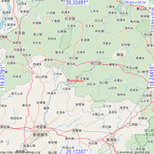
Rongkou GPS coordinates[2]
29° 44' 43.44" North, 117° 32' 27.708" East
| Map corner | latitude | longitude |
|---|---|---|
| Upper-left | 30.35401°, | 116.83791° |
| Center: | 29.7454°, | 117.54103° |
| Lower-right: | 29.13307°, | 118.24416° |
| Map W x H: | 135.8×135.8 km | = 84.4×84.4mi |
| max Lat: | 53.31946° ⇑56.9% North |
| Rongkou: | 29.7454° |
| min Lat: | ⇓43.1% South 18.22056° |
| min Long | Rongkou | max Long |
| 75.07348° | 117.54103° | 134.28917° |
| W 68.9%⇐ | ⇒31.1% E |
Elevation
Elevation of Rongkou is 101 m = 331 ft, and this is 383.8 m = 1259 ft below average elevation for this country.
| Max E: |
5622 m = 18445 ft | 59.5% |
| Avg. | 484.8 m = 1591 ft | |
| Rongkou | 101 m = 331 ft | |
Min E: |
-3 m = -10 ft | 40.5% |
See also: China elevation on elevation.city.
Geographical zone
Rongkou is located in North temperate zone (between Tropic of Cancer and the Arctic Circle). Distance of this Northern Tropic circle is 701.5 km =435.9 mi to South.| Distance of | km | miles | from Rongkou |
|---|---|---|---|
| North Pole | 6699.7 | 4163 | to North |
| Arctic Circle | 4093.8 | 2543.8 | to North |
| Tropic Cancer | 701.5 | 435.9 | to South |
| Equator | 3307.4 | 2055.1 | to South |


Nearby cities:
15 places around Rongkou: (largest is in red/bold)
• Dengta
18.3 km =11.4 mi,  41°
41°
• Guxi
22.8 km =14.2 mi,  8°
8°
• Hecheng
19.8 km =12.3 mi,  119°
119°
• Jiangcun
17.4 km =10.8 mi,  279°
279°
• Likou
17.6 km =10.9 mi,  349°
349°
• Luxi
5.4 km =3.4 mi,  218°
218°
• Pingli
6.6 km =4.1 mi,  98°
98°
• Qiaoshan
17.3 km =10.7 mi,  83°
83°
• Qihong
13.5 km =8.4 mi,  114°
114°
• Qishan
20.4 km =12.7 mi,  57°
57°
• Tafang
12.5 km =7.8 mi,  71°
71°
• Xiaolukou
14.4 km =8.9 mi,  26°
26°
• Yangshu
22.5 km =14 mi, 352°
• Yaoli
22.4 km =13.9 mi,  171°
171°
• Zhukou
13.3 km =8.3 mi,  335°
335°
Sources, notices
• [Note1] Compared only with cities in China existing in our database
• [Src1] Map data: © OpenStreetMap contributors (CC-BY-SA)
• [Src2] Other city data from geonames.org with taken over terms of usage.
• [Src3] Geographical zone / Annual Mean Temperature by Robert A. Rohde @ Wikipedia
