Baiyang geodata
Baiyang (Ningxia Hui Autonomous Region) is a seat of a third-order administrative division; located in China in Asia/Shanghai (GMT+8) time zone. In our database, there are 1268 cities with bigger population. Compared to other cities in China, 76.9% of cities are located further ↓South; 84.7% of cities are located further →East and 91.2% of cities have lower elevation than Baiyang. Note1


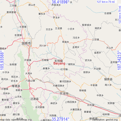
Baiyang GPS coordinates[2]
35° 51' 3.96" North, 106° 38' 20.4" East
| Map corner | latitude | longitude |
|---|---|---|
| Upper-left | 36.41896°, | 105.93588° |
| Center: | 35.8511°, | 106.639° |
| Lower-right: | 35.27914°, | 107.34213° |
| Map W x H: | 126.7×126.7 km | = 78.7×78.7mi |
| max Lat: | 53.31946° ⇑23.1% North |
| Baiyang: | 35.8511° |
| min Lat: | ⇓76.9% South 18.22056° |
| min Long | Baiyang | max Long |
| 75.07348° | 106.639° | 134.28917° |
| W 15.3%⇐ | ⇒84.7% E |
Elevation
Elevation of Baiyang is 1472 m = 4829 ft, and this is 987.2 m = 3239 ft above average elevation for this country.
| Max E: |
5622 m = 18445 ft | 8.8% |
| Baiyang | 1472 m 4829 ft | |
| Avg. | 484.8 m = 1591 ft | |
Min E: |
-3 m = -10 ft | 91.2% |
See also: China elevation on elevation.city.
Geographical zone
Baiyang is located in North temperate zone (between Tropic of Cancer and the Arctic Circle). Distance of this Northern Tropic circle is 1380.3 km =857.7 mi to South.| Distance of | km | miles | from Baiyang |
|---|---|---|---|
| North Pole | 6020.8 | 3741.2 | to North |
| Arctic Circle | 3414.9 | 2121.9 | to North |
| Tropic Cancer | 1380.3 | 857.7 | to South |
| Equator | 3986.3 | 2477 | to South |


Nearby cities:
15 places around Baiyang: (largest is in red/bold)
• Beiwa
32.1 km =19.9 mi,  355°
355°
• Caomiao
20.6 km =12.8 mi,  15°
15°
• Chengjiao
35.5 km =22.1 mi,  299°
299°
• Chengyang
13.6 km =8.5 mi,  106°
106°
• Dongjiao
35.9 km =22.3 mi, 298°
• Gonghe
34.5 km =21.4 mi,  314°
314°
• Guanting
40.1 km =24.9 mi,  329°
329°
• Gucheng
16.3 km =10.1 mi,  272°
272°
• Honghe
10.9 km =6.8 mi,  149°
149°
• Jiaocha
34.8 km =21.6 mi,  340°
340°
• Pingliang
34.9 km =21.7 mi,  173°
173°
• Shicha
19.2 km =11.9 mi, 335°
• Xiaocha
35.2 km =21.9 mi, 17°
• Xiawangwa
28.3 km =17.6 mi, 359°
• Xijiao
37.1 km =23.1 mi, 298°
Sources, notices
• [Note1] Compared only with cities in China existing in our database
• [Src1] Map data: © OpenStreetMap contributors (CC-BY-SA)
• [Src2] Other city data from geonames.org with taken over terms of usage.
• [Src3] Geographical zone / Annual Mean Temperature by Robert A. Rohde @ Wikipedia
