Honghe geodata
Honghe (Ningxia Hui Autonomous Region) is a seat of a fourth-order administrative division; located in China in Asia/Shanghai (GMT+8) time zone. In our database, there are 1268 cities with bigger population. Compared to other cities in China, 76.7% of cities are located further ↓South; 84.6% of cities are located further →East and 90.6% of cities have lower elevation than Honghe. Note1


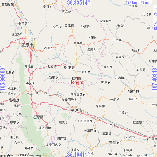
Honghe GPS coordinates[2]
35° 46' 0.012" North, 106° 42' 0" East
| Map corner | latitude | longitude |
|---|---|---|
| Upper-left | 36.33514°, | 105.99688° |
| Center: | 35.76667°, | 106.7° |
| Lower-right: | 35.19411°, | 107.40313° |
| Map W x H: | 126.9×126.9 km | = 78.9×78.9mi |
| max Lat: | 53.31946° ⇑23.3% North |
| Honghe: | 35.76667° |
| min Lat: | ⇓76.7% South 18.22056° |
| min Long | Honghe | max Long |
| 75.07348° | 106.7° | 134.28917° |
| W 15.4%⇐ | ⇒84.6% E |
Elevation
Elevation of Honghe is 1420 m = 4659 ft, and this is 935.2 m = 3068 ft above average elevation for this country.
| Max E: |
5622 m = 18445 ft | 9.4% |
| Honghe | 1420 m 4659 ft | |
| Avg. | 484.8 m = 1591 ft | |
Min E: |
-3 m = -10 ft | 90.6% |
See also: China elevation on elevation.city.
Geographical zone
Honghe is located in North temperate zone (between Tropic of Cancer and the Arctic Circle). Distance of this Northern Tropic circle is 1371 km =851.9 mi to South.| Distance of | km | miles | from Honghe |
|---|---|---|---|
| North Pole | 6030.2 | 3747 | to North |
| Arctic Circle | 3424.3 | 2127.8 | to North |
| Tropic Cancer | 1371 | 851.9 | to South |
| Equator | 3976.9 | 2471.1 | to South |


Nearby cities:
15 places around Honghe: (largest is in red/bold)
• Baiyang
10.9 km =6.8 mi,  329°
329°
• Beiwa
42.2 km =26.2 mi,  348°
348°
• Caomiao
29.2 km =18.1 mi,  359°
359°
• Chengjiao
45.2 km =28.1 mi,  306°
306°
• Chengyang
9.3 km =5.8 mi,  53°
53°
• Dongjiao
45.5 km =28.3 mi, 305°
• Gonghe
45.1 km =28 mi,  318°
318°
• Gucheng
24 km =14.9 mi,  294°
294°
• Jiaocha
45.6 km =28.3 mi,  337°
337°
• Pingliang
25.3 km =15.7 mi,  182°
182°
• Sancha
44.4 km =27.6 mi,  44°
44°
• Shicha
30 km =18.6 mi, 333°
• Xiaocha
43.2 km =26.8 mi,  7°
7°
• Xiawangwa
38.2 km =23.7 mi, 351°
• Zhenyuan Chengguanzhen
45.9 km =28.5 mi,  102°
102°
Sources, notices
• [Note1] Compared only with cities in China existing in our database
• [Src1] Map data: © OpenStreetMap contributors (CC-BY-SA)
• [Src2] Other city data from geonames.org with taken over terms of usage.
• [Src3] Geographical zone / Annual Mean Temperature by Robert A. Rohde @ Wikipedia
