Dadukou geodata
Dadukou (Sichuan) is a seat of a third-order administrative division; located in China in Asia/Shanghai (GMT+8) time zone. With population of 461,513 people, there are 139 cities with bigger population in this country. Compared to other cities in China, 80.3% of cities are located further ↑North; 93.2% of cities are located further →East and 87% of cities have lower elevation than Dadukou. Note1


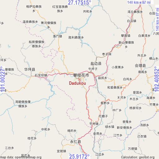
Dadukou GPS coordinates[2]
26° 32' 52.44" North, 101° 42' 19.404" East
| Map corner | latitude | longitude |
|---|---|---|
| Upper-left | 27.17515°, | 101.00227° |
| Center: | 26.5479°, | 101.70539° |
| Lower-right: | 25.9172°, | 102.40852° |
| Map W x H: | 139.9×139.9 km | = 86.9×86.9mi |
| max Lat: | 53.31946° ⇑80.3% North |
| Dadukou: | 26.5479° |
| min Lat: | ⇓19.7% South 18.22056° |
| min Long | Dadukou | max Long |
| 75.07348° | 101.70539° | 134.28917° |
| W 6.8%⇐ | ⇒93.2% E |
Elevation
Elevation of Dadukou is 1110 m = 3642 ft, and this is 625.2 m = 2051 ft above average elevation for this country.
| Max E: |
5622 m = 18445 ft | 13% |
| Dadukou | 1110 m 3642 ft | |
| Avg. | 484.8 m = 1591 ft | |
Min E: |
-3 m = -10 ft | 87% |
See also: Dadukou elevation on elevation.city.
Geographical zone
Dadukou is located in North temperate zone (between Tropic of Cancer and the Arctic Circle). Distance of this Northern Tropic circle is 345.9 km =214.9 mi to South.| Distance of | km | miles | from Dadukou |
|---|---|---|---|
| North Pole | 7055.2 | 4383.9 | to North |
| Arctic Circle | 4449.3 | 2764.7 | to North |
| Tropic Cancer | 345.9 | 214.9 | to South |
| Equator | 2951.8 | 1834.2 | to South |


Nearby cities:
15 places around Dadukou: (largest is in red/bold)
• Huidong
87.1 km =54.1 mi,  83°
83°
• Huili Chengguanzhen
55 km =34.2 mi, 76°
• Jiaoxiyakou
87.7 km =54.5 mi,  122°
122°
• Muzeng
94.8 km =58.9 mi,  125°
125°
• Panlian
55 km =34.2 mi,  46°
46°
• Panzhihua
4.2 km =2.6 mi,  10°
10°
• Pujiawan
70.9 km =44.1 mi, 124°
• Qianjin
1 km =0.6 mi,  232°
232°
• Renhe
6.3 km =3.9 mi,  148°
148°
• Tongzilin
22.3 km =13.9 mi,  40°
40°
• Xiqu
12.4 km =7.7 mi,  301°
301°
• Yongbei
92.6 km =57.5 mi,  276°
276°
• Yongding
56.4 km =35 mi,  181°
181°
• Yuquan
12.3 km =7.6 mi, 301°
• Zhongxin
43.8 km =27.2 mi, 280°
Sources, notices
• [Note1] Compared only with cities in China existing in our database
• [Src1] Map data: © OpenStreetMap contributors (CC-BY-SA)
• [Src2] Other city data from geonames.org with taken over terms of usage.
• [Src3] Geographical zone / Annual Mean Temperature by Robert A. Rohde @ Wikipedia
