Nanshan geodata
Nanshan (Fujian) is a seat of a fourth-order administrative division; located in China in Asia/Shanghai (GMT+8) time zone. In our database, there are 1268 cities with bigger population. Compared to other cities in China, 83.9% of cities are located further ↑North; 63% of cities are located further ←West and 64.1% of cities have lower elevation than Nanshan. Note1


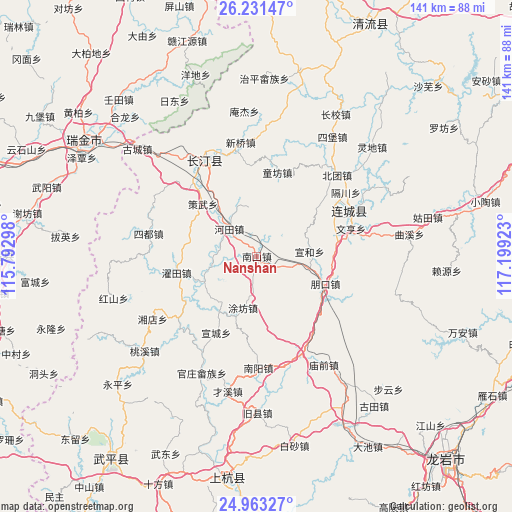
Nanshan GPS coordinates[2]
25° 35' 56.58" North, 116° 29' 45.96" East
| Map corner | latitude | longitude |
|---|---|---|
| Upper-left | 26.23147°, | 115.79298° |
| Center: | 25.59905°, | 116.4961° |
| Lower-right: | 24.96327°, | 117.19923° |
| Map W x H: | 141×141 km | = 87.6×87.6mi |
| max Lat: | 53.31946° ⇑83.9% North |
| Nanshan: | 25.59905° |
| min Lat: | ⇓16.1% South 18.22056° |
| min Long | Nanshan | max Long |
| 75.07348° | 116.4961° | 134.28917° |
| W 63%⇐ | ⇒37% E |
Elevation
Elevation of Nanshan is 312 m = 1024 ft, and this is 172.8 m = 567 ft below average elevation for this country.
| Max E: |
5622 m = 18445 ft | 35.9% |
| Avg. | 484.8 m = 1591 ft | |
| Nanshan | 312 m = 1024 ft | |
Min E: |
-3 m = -10 ft | 64.1% |
See also: China elevation on elevation.city.
Geographical zone
Nanshan is located in North temperate zone (between Tropic of Cancer and the Arctic Circle). Distance of this Northern Tropic circle is 240.4 km =149.4 mi to South.| Distance of | km | miles | from Nanshan |
|---|---|---|---|
| North Pole | 7160.7 | 4449.5 | to North |
| Arctic Circle | 4554.8 | 2830.2 | to North |
| Tropic Cancer | 240.4 | 149.4 | to South |
| Equator | 2846.3 | 1768.6 | to South |


Nearby cities:
15 places around Nanshan: (largest is in red/bold)
• Cewu
20.7 km =12.9 mi,  314°
314°
• Hetian
11.1 km =6.9 mi, 313°
• Juxi
27 km =16.8 mi,  115°
115°
• Lianfeng
25.5 km =15.8 mi,  62°
62°
• Luofang
25.3 km =15.7 mi,  48°
48°
• Pengkou
20.4 km =12.7 mi,  111°
111°
• Sanzhou
11.8 km =7.3 mi,  266°
266°
• Tongfang
23.4 km =14.5 mi,  13°
13°
• Tufang
14.7 km =9.1 mi,  195°
195°
• Wenheng
27 km =16.8 mi,  73°
73°
• Xinquan
29.5 km =18.3 mi,  156°
156°
• Xuancheng
23.9 km =14.9 mi,  208°
208°
• Xuanhe
14.6 km =9.1 mi,  85°
85°
• Yanggu
29.8 km =18.5 mi,  217°
217°
• Zhuotian
22.6 km =14 mi,  258°
258°
Sources, notices
• [Note1] Compared only with cities in China existing in our database
• [Src1] Map data: © OpenStreetMap contributors (CC-BY-SA)
• [Src2] Other city data from geonames.org with taken over terms of usage.
• [Src3] Geographical zone / Annual Mean Temperature by Robert A. Rohde @ Wikipedia
