Nanjiao geodata
Nanjiao (Beijing) is a seat of a fourth-order administrative division; located in China in Asia/Shanghai (GMT+8) time zone. In our database, there are 1268 cities with bigger population. Compared to other cities in China, 85.5% of cities are located further ↓South; 59.1% of cities are located further ←West and 65.1% of cities have lower elevation than Nanjiao. Note1


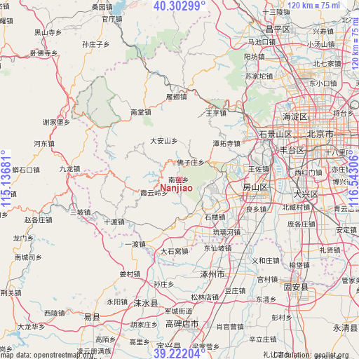
Nanjiao GPS coordinates[2]
39° 45' 52.704" North, 115° 50' 23.748" East
| Map corner | latitude | longitude |
|---|---|---|
| Upper-left | 40.30299°, | 115.13681° |
| Center: | 39.76464°, | 115.83993° |
| Lower-right: | 39.22204°, | 116.54306° |
| Map W x H: | 120.2×120.2 km | = 74.7×74.7mi |
| max Lat: | 53.31946° ⇑14.5% North |
| Nanjiao: | 39.76464° |
| min Lat: | ⇓85.5% South 18.22056° |
| min Long | Nanjiao | max Long |
| 75.07348° | 115.83993° | 134.28917° |
| W 59.1%⇐ | ⇒40.9% E |
Elevation
Elevation of Nanjiao is 327 m = 1073 ft, and this is 157.8 m = 518 ft below average elevation for this country.
| Max E: |
5622 m = 18445 ft | 34.9% |
| Avg. | 484.8 m = 1591 ft | |
| Nanjiao | 327 m = 1073 ft | |
Min E: |
-3 m = -10 ft | 65.1% |
See also: China elevation on elevation.city.
Geographical zone
Nanjiao is located in North temperate zone (between Tropic of Cancer and the Arctic Circle). Distance of this Northern Tropic circle is 1815.5 km =1128.1 mi to South.| Distance of | km | miles | from Nanjiao |
|---|---|---|---|
| North Pole | 5585.6 | 3470.7 | to North |
| Arctic Circle | 2979.8 | 1851.6 | to North |
| Tropic Cancer | 1815.5 | 1128.1 | to South |
| Equator | 4421.4 | 2747.3 | to South |


Nearby cities:
15 places around Nanjiao: (largest is in red/bold)
• Changgou
21.7 km =13.5 mi,  167°
167°
• Dashiwo
23.5 km =14.6 mi,  185°
185°
• Da’anshan
14.5 km =9 mi,  338°
338°
• Fangshan
15.9 km =9.9 mi,  122°
122°
• Hebei
9.6 km =6 mi,  54°
54°
• Liangxiang
25.3 km =15.7 mi,  97°
97°
• Liulihe
24.8 km =15.4 mi,  138°
138°
• Qinglonghu
16.6 km =10.3 mi,  86°
86°
• Shijiaying
18.2 km =11.3 mi,  304°
304°
• Tanzhesi
20 km =12.4 mi, 53°
• Wangping
25.6 km =15.9 mi,  28°
28°
• Xiangyang
10.3 km =6.4 mi, 103°
• Xiayunling
9.9 km =6.2 mi,  243°
243°
• Zhangfang
24.4 km =15.2 mi,  207°
207°
• Zhoukoudian
12.1 km =7.5 mi, 137°
Sources, notices
• [Note1] Compared only with cities in China existing in our database
• [Src1] Map data: © OpenStreetMap contributors (CC-BY-SA)
• [Src2] Other city data from geonames.org with taken over terms of usage.
• [Src3] Geographical zone / Annual Mean Temperature by Robert A. Rohde @ Wikipedia
