Shijiaying geodata
Shijiaying (Beijing) is a seat of a fourth-order administrative division; located in China in Asia/Shanghai (GMT+8) time zone. In our database, there are 1268 cities with bigger population. Compared to other cities in China, 85.9% of cities are located further ↓South; 57.9% of cities are located further ←West and 79.8% of cities have lower elevation than Shijiaying. Note1


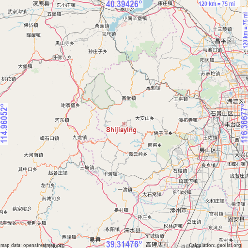
Shijiaying GPS coordinates[2]
39° 51' 23.868" North, 115° 39' 49.104" East
| Map corner | latitude | longitude |
|---|---|---|
| Upper-left | 40.39426°, | 114.96052° |
| Center: | 39.85663°, | 115.66364° |
| Lower-right: | 39.31476°, | 116.36677° |
| Map W x H: | 120×120 km | = 74.6×74.6mi |
| max Lat: | 53.31946° ⇑14.1% North |
| Shijiaying: | 39.85663° |
| min Lat: | ⇓85.9% South 18.22056° |
| min Long | Shijiaying | max Long |
| 75.07348° | 115.66364° | 134.28917° |
| W 57.9%⇐ | ⇒42.1% E |
Elevation
Elevation of Shijiaying is 686 m = 2251 ft, and this is 201.2 m = 660 ft above average elevation for this country.
| Max E: |
5622 m = 18445 ft | 20.2% |
| Shijiaying | 686 m 2251 ft | |
| Avg. | 484.8 m = 1591 ft | |
Min E: |
-3 m = -10 ft | 79.8% |
See also: China elevation on elevation.city.
Geographical zone
Shijiaying is located in North temperate zone (between Tropic of Cancer and the Arctic Circle). Distance of this Northern Tropic circle is 1825.7 km =1134.4 mi to South.| Distance of | km | miles | from Shijiaying |
|---|---|---|---|
| North Pole | 5575.4 | 3464.4 | to North |
| Arctic Circle | 2969.5 | 1845.2 | to North |
| Tropic Cancer | 1825.7 | 1134.4 | to South |
| Equator | 4431.6 | 2753.7 | to South |


Nearby cities:
15 places around Shijiaying: (largest is in red/bold)
• Da’anshan
10.3 km =6.4 mi,  71°
71°
• Hebei
23.3 km =14.5 mi,  101°
101°
• Nanjiao
18.2 km =11.3 mi,  124°
124°
• Puwa
17.3 km =10.7 mi,  219°
219°
• Qingshui
10.6 km =6.6 mi,  336°
336°
• Shidu
24.7 km =15.3 mi,  195°
195°
• Tanzhesi
31.2 km =19.4 mi,  86°
86°
• Wangping
29.7 km =18.5 mi, 65°
• Xiangyang
28.1 km =17.5 mi, 116°
• Xiayunling
16 km =9.9 mi,  157°
157°
• Yanchi
22.5 km =14 mi,  38°
38°
• Yanjiatai
18.2 km =11.3 mi,  331°
331°
• Zhaitang
12.9 km =8 mi,  10°
10°
• Zhangfang
32 km =19.9 mi,  173°
173°
• Zhoukoudian
30.1 km =18.7 mi,  129°
129°
Sources, notices
• [Note1] Compared only with cities in China existing in our database
• [Src1] Map data: © OpenStreetMap contributors (CC-BY-SA)
• [Src2] Other city data from geonames.org with taken over terms of usage.
• [Src3] Geographical zone / Annual Mean Temperature by Robert A. Rohde @ Wikipedia
