Nanfeng geodata
Nanfeng (Jiangsu) is a seat of a fourth-order administrative division; located in China in Asia/Shanghai (GMT+8) time zone. In our database, there are 1268 cities with bigger population. Compared to other cities in China, 60.5% of cities are located further ↓South; 86% of cities are located further ←West and 94.3% of cities have higher elevation than Nanfeng. Note1


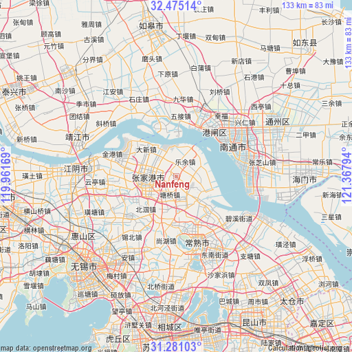
Nanfeng GPS coordinates[2]
31° 52' 48.072" North, 120° 39' 53.316" East
| Map corner | latitude | longitude |
|---|---|---|
| Upper-left | 32.47514°, | 119.96169° |
| Center: | 31.88002°, | 120.66481° |
| Lower-right: | 31.28103°, | 121.36794° |
| Map W x H: | 132.8×132.8 km | = 82.5×82.5mi |
| max Lat: | 53.31946° ⇑39.5% North |
| Nanfeng: | 31.88002° |
| min Lat: | ⇓60.5% South 18.22056° |
| min Long | Nanfeng | max Long |
| 75.07348° | 120.66481° | 134.28917° |
| W 86%⇐ | ⇒14% E |
Elevation
Elevation of Nanfeng is 7 m = 23 ft, and this is 477.8 m = 1568 ft below average elevation for this country.
| Max E: |
5622 m = 18445 ft | 94.3% |
| Avg. | 484.8 m = 1591 ft | |
| Nanfeng | 7 m = 23 ft | |
Min E: |
-3 m = -10 ft | 5.7% |
See also: China elevation on elevation.city.
Geographical zone
Nanfeng is located in North temperate zone (between Tropic of Cancer and the Arctic Circle). Distance of this Northern Tropic circle is 938.8 km =583.3 mi to South.| Distance of | km | miles | from Nanfeng |
|---|---|---|---|
| North Pole | 6462.3 | 4015.5 | to North |
| Arctic Circle | 3856.4 | 2396.3 | to North |
| Tropic Cancer | 938.8 | 583.3 | to South |
| Equator | 3544.7 | 2202.6 | to South |


Nearby cities:
15 places around Nanfeng: (largest is in red/bold)
• Changjing
22.5 km =14 mi,  231°
231°
• Daxin
15.4 km =9.6 mi,  311°
311°
• Fenghuang
10.6 km =6.6 mi,  201°
201°
• Gushan
19.7 km =12.2 mi,  213°
213°
• Haiyu
19.2 km =11.9 mi,  137°
137°
• Huashi
19.7 km =12.2 mi,  255°
255°
• Jinfeng
9.2 km =5.7 mi,  349°
349°
• Langshan
22.5 km =14 mi,  67°
67°
• Leyu
6.2 km =3.9 mi,  29°
29°
• Rengang
21.6 km =13.4 mi,  47°
47°
• Shanghu
23.7 km =14.7 mi,  188°
188°
• Tangzha
24.3 km =15.1 mi, 32°
• Wujie
23 km =14.3 mi,  3°
3°
• Xinqiao
17.4 km =10.8 mi,  240°
240°
• Zhangjiagang
12 km =7.5 mi, 262°
Sources, notices
• [Note1] Compared only with cities in China existing in our database
• [Src1] Map data: © OpenStreetMap contributors (CC-BY-SA)
• [Src2] Other city data from geonames.org with taken over terms of usage.
• [Src3] Geographical zone / Annual Mean Temperature by Robert A. Rohde @ Wikipedia
