Jinfeng geodata
Jinfeng (Jiangsu) is a seat of a fourth-order administrative division; located in China in Asia/Shanghai (GMT+8) time zone. In our database, there are 1268 cities with bigger population. Compared to other cities in China, 61% of cities are located further ↓South; 85.9% of cities are located further ←West and 98.3% of cities have higher elevation than Jinfeng. Note1


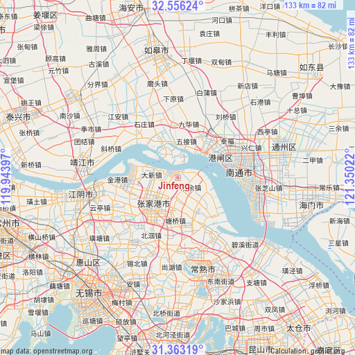
Jinfeng GPS coordinates[2]
31° 57' 41.94" North, 120° 38' 49.524" East
| Map corner | latitude | longitude |
|---|---|---|
| Upper-left | 32.55624°, | 119.94397° |
| Center: | 31.96165°, | 120.64709° |
| Lower-right: | 31.36319°, | 121.35022° |
| Map W x H: | 132.7×132.7 km | = 82.5×82.5mi |
| max Lat: | 53.31946° ⇑39% North |
| Jinfeng: | 31.96165° |
| min Lat: | ⇓61% South 18.22056° |
| min Long | Jinfeng | max Long |
| 75.07348° | 120.64709° | 134.28917° |
| W 85.9%⇐ | ⇒14.1% E |
Elevation
Elevation of Jinfeng is 4 m = 13 ft, and this is 480.8 m = 1577 ft below average elevation for this country.
| Max E: |
5622 m = 18445 ft | 98.3% |
| Avg. | 484.8 m = 1591 ft | |
| Jinfeng | 4 m = 13 ft | |
Min E: |
-3 m = -10 ft | 1.7% |
See also: China elevation on elevation.city.
Geographical zone
Jinfeng is located in North temperate zone (between Tropic of Cancer and the Arctic Circle). Distance of this Northern Tropic circle is 947.9 km =589 mi to South.| Distance of | km | miles | from Jinfeng |
|---|---|---|---|
| North Pole | 6453.3 | 4009.9 | to North |
| Arctic Circle | 3847.4 | 2390.7 | to North |
| Tropic Cancer | 947.9 | 589 | to South |
| Equator | 3553.8 | 2208.2 | to South |


Nearby cities:
15 places around Jinfeng: (largest is in red/bold)
• Changjiang
17.9 km =11.1 mi,  332°
332°
• Chenqiao
21.5 km =13.4 mi,  42°
42°
• Daxin
9.9 km =6.2 mi,  276°
276°
• Fenghuang
19.1 km =11.9 mi,  186°
186°
• Huashi
22.4 km =13.9 mi,  230°
230°
• Jiuhua
19.5 km =12.1 mi,  1°
1°
• Leyu
6 km =3.7 mi,  127°
127°
• Nanfeng
9.2 km =5.7 mi,  169°
169°
• Pingchao
17.9 km =11.1 mi,  29°
29°
• Pingdong
21.8 km =13.5 mi, 34°
• Rengang
18.5 km =11.5 mi,  72°
72°
• Tangzha
18.7 km =11.6 mi,  52°
52°
• Wujie
14.2 km =8.8 mi,  12°
12°
• Xinqiao
22.2 km =13.8 mi,  217°
217°
• Zhangjiagang
14.8 km =9.2 mi, 223°
Sources, notices
• [Note1] Compared only with cities in China existing in our database
• [Src1] Map data: © OpenStreetMap contributors (CC-BY-SA)
• [Src2] Other city data from geonames.org with taken over terms of usage.
• [Src3] Geographical zone / Annual Mean Temperature by Robert A. Rohde @ Wikipedia
