Leyu geodata
Leyu (Jiangsu) is a seat of a fourth-order administrative division; located in China in Asia/Shanghai (GMT+8) time zone. In our database, there are 1268 cities with bigger population. Compared to other cities in China, 60.8% of cities are located further ↓South; 86.2% of cities are located further ←West and 98.3% of cities have higher elevation than Leyu. Note1


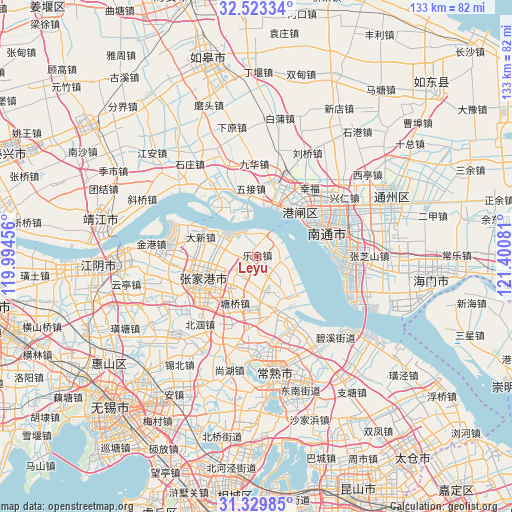
Leyu GPS coordinates[2]
31° 55' 42.708" North, 120° 41' 51.648" East
| Map corner | latitude | longitude |
|---|---|---|
| Upper-left | 32.52334°, | 119.99456° |
| Center: | 31.92853°, | 120.69768° |
| Lower-right: | 31.32985°, | 121.40081° |
| Map W x H: | 132.7×132.7 km | = 82.5×82.5mi |
| max Lat: | 53.31946° ⇑39.2% North |
| Leyu: | 31.92853° |
| min Lat: | ⇓60.8% South 18.22056° |
| min Long | Leyu | max Long |
| 75.07348° | 120.69768° | 134.28917° |
| W 86.2%⇐ | ⇒13.8% E |
Elevation
Elevation of Leyu is 4 m = 13 ft, and this is 480.8 m = 1577 ft below average elevation for this country.
| Max E: |
5622 m = 18445 ft | 98.3% |
| Avg. | 484.8 m = 1591 ft | |
| Leyu | 4 m = 13 ft | |
Min E: |
-3 m = -10 ft | 1.7% |
See also: China elevation on elevation.city.
Geographical zone
Leyu is located in North temperate zone (between Tropic of Cancer and the Arctic Circle). Distance of this Northern Tropic circle is 944.2 km =586.7 mi to South.| Distance of | km | miles | from Leyu |
|---|---|---|---|
| North Pole | 6456.9 | 4012.1 | to North |
| Arctic Circle | 3851.1 | 2393 | to North |
| Tropic Cancer | 944.2 | 586.7 | to South |
| Equator | 3550.1 | 2205.9 | to South |


Nearby cities:
15 places around Leyu: (largest is in red/bold)
• Chenqiao
21.8 km =13.5 mi,  26°
26°
• Daxin
15.4 km =9.6 mi,  288°
288°
• Fenghuang
16.8 km =10.4 mi,  204°
204°
• Haiyu
21.9 km =13.6 mi,  153°
153°
• Jinfeng
6 km =3.7 mi,  307°
307°
• Langshan
18 km =11.2 mi,  79°
79°
• Nanfeng
6.2 km =3.9 mi,  209°
209°
• Nantong
20.2 km =12.6 mi,  55°
55°
• Pingchao
19.6 km =12.2 mi,  11°
11°
• Qinzao
21.6 km =13.4 mi,  45°
45°
• Rengang
15.8 km =9.8 mi, 54°
• Tangzha
18.1 km =11.2 mi, 33°
• Wujie
17.6 km =10.9 mi,  354°
354°
• Yongxing
21 km =13 mi,  91°
91°
• Zhangjiagang
16.6 km =10.3 mi,  244°
244°
Sources, notices
• [Note1] Compared only with cities in China existing in our database
• [Src1] Map data: © OpenStreetMap contributors (CC-BY-SA)
• [Src2] Other city data from geonames.org with taken over terms of usage.
• [Src3] Geographical zone / Annual Mean Temperature by Robert A. Rohde @ Wikipedia
