Shanghu geodata
Shanghu (Jiangsu) is a seat of a fourth-order administrative division; located in China in Asia/Shanghai (GMT+8) time zone. In our database, there are 1268 cities with bigger population. Compared to other cities in China, 59.3% of cities are located further ↓South; 85.8% of cities are located further ←West and 97.2% of cities have higher elevation than Shanghu. Note1


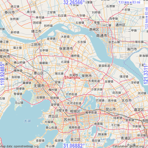
Shanghu GPS coordinates[2]
31° 40' 9.012" North, 120° 37' 40.692" East
| Map corner | latitude | longitude |
|---|---|---|
| Upper-left | 32.26566°, | 119.92485° |
| Center: | 31.66917°, | 120.62797° |
| Lower-right: | 31.06882°, | 121.3311° |
| Map W x H: | 133.1×133.1 km | = 82.7×82.7mi |
| max Lat: | 53.31946° ⇑40.7% North |
| Shanghu: | 31.66917° |
| min Lat: | ⇓59.3% South 18.22056° |
| min Long | Shanghu | max Long |
| 75.07348° | 120.62797° | 134.28917° |
| W 85.8%⇐ | ⇒14.2% E |
Elevation
Elevation of Shanghu is 5 m = 16 ft, and this is 479.8 m = 1574 ft below average elevation for this country.
| Max E: |
5622 m = 18445 ft | 97.2% |
| Avg. | 484.8 m = 1591 ft | |
| Shanghu | 5 m = 16 ft | |
Min E: |
-3 m = -10 ft | 2.8% |
See also: China elevation on elevation.city.
Geographical zone
Shanghu is located in North temperate zone (between Tropic of Cancer and the Arctic Circle). Distance of this Northern Tropic circle is 915.4 km =568.8 mi to South.| Distance of | km | miles | from Shanghu |
|---|---|---|---|
| North Pole | 6485.8 | 4030.1 | to North |
| Arctic Circle | 3879.9 | 2410.9 | to North |
| Tropic Cancer | 915.4 | 568.8 | to South |
| Equator | 3521.3 | 2188 | to South |


Nearby cities:
15 places around Shanghu: (largest is in red/bold)
• Anzhen
16.3 km =10.1 mi,  246°
246°
• Beiqiao
18.1 km =11.2 mi,  189°
189°
• Changjing
17.1 km =10.6 mi,  303°
303°
• Changshu City
11.1 km =6.9 mi,  103°
103°
• Ehu
17.9 km =11.1 mi,  206°
206°
• Fenghuang
13.6 km =8.5 mi,  358°
358°
• Guli
20 km =12.4 mi, 101°
• Gushan
10.3 km =6.4 mi,  313°
313°
• Haiyu
18.8 km =11.7 mi,  60°
60°
• Xibei
18.6 km =11.6 mi,  266°
266°
• Xinqiao
18.9 km =11.7 mi,  321°
321°
• Xinzhuang
15.7 km =9.8 mi,  158°
158°
• Yangdenghu
21.5 km =13.4 mi, 155°
• Yangjian
8.3 km =5.2 mi,  237°
237°
• Yushan
16.4 km =10.2 mi,  86°
86°
Sources, notices
• [Note1] Compared only with cities in China existing in our database
• [Src1] Map data: © OpenStreetMap contributors (CC-BY-SA)
• [Src2] Other city data from geonames.org with taken over terms of usage.
• [Src3] Geographical zone / Annual Mean Temperature by Robert A. Rohde @ Wikipedia
