Huichang geodata
Huichang (Henan) is a seat of a third-order administrative division; located in China in Asia/Shanghai (GMT+8) time zone. In our database, there are 1268 cities with bigger population. Compared to other cities in China, 74.7% of cities are located further ↓South; 58.8% of cities are located further →East and 57.1% of cities have higher elevation than Huichang. Note1


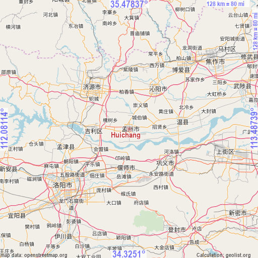
Huichang GPS coordinates[2]
34° 54' 13.536" North, 112° 47' 3.336" East
| Map corner | latitude | longitude |
|---|---|---|
| Upper-left | 35.47837°, | 112.08114° |
| Center: | 34.90376°, | 112.78426° |
| Lower-right: | 34.3251°, | 113.48739° |
| Map W x H: | 128.2×128.2 km | = 79.7×79.7mi |
| max Lat: | 53.31946° ⇑25.3% North |
| Huichang: | 34.90376° |
| min Lat: | ⇓74.7% South 18.22056° |
| min Long | Huichang | max Long |
| 75.07348° | 112.78426° | 134.28917° |
| W 41.2%⇐ | ⇒58.8% E |
Elevation
Elevation of Huichang is 117 m = 384 ft, and this is 367.8 m = 1207 ft below average elevation for this country.
| Max E: |
5622 m = 18445 ft | 57.1% |
| Avg. | 484.8 m = 1591 ft | |
| Huichang | 117 m = 384 ft | |
Min E: |
-3 m = -10 ft | 42.9% |
See also: China elevation on elevation.city.
Geographical zone
Huichang is located in North temperate zone (between Tropic of Cancer and the Arctic Circle). Distance of this Northern Tropic circle is 1275 km =792.2 mi to South.| Distance of | km | miles | from Huichang |
|---|---|---|---|
| North Pole | 6126.1 | 3806.6 | to North |
| Arctic Circle | 3520.2 | 2187.4 | to North |
| Tropic Cancer | 1275 | 792.2 | to South |
| Equator | 3880.9 | 2411.5 | to South |


Nearby cities:
15 places around Huichang: (largest is in red/bold)
• Changping
39.7 km =24.7 mi,  19°
19°
• Daqinglu
18.3 km =11.4 mi,  268°
268°
• Jiyuan
27.8 km =17.3 mi,  318°
318°
• Jiyuanlu
45 km =28 mi,  101°
101°
• Luoyang
38.9 km =24.2 mi,  230°
230°
• Mengjin Chengguanzhen
33.3 km =20.7 mi,  255°
255°
• Qinghua
38.5 km =23.9 mi,  41°
41°
• Songyang
54.6 km =33.9 mi,  155°
155°
• Suohe
53.9 km =33.5 mi, 103°
• Tanbei
24.9 km =15.5 mi,  34°
34°
• Wenquan
26.6 km =16.5 mi,  82°
82°
• Xixiang
29.7 km =18.5 mi,  14°
14°
• Yanshi Chengguanzhen
20.9 km =13 mi,  177°
177°
• Zhongzhan
50.8 km =31.6 mi, 42°
• Zijinglu
23.4 km =14.5 mi,  133°
133°
Sources, notices
• [Note1] Compared only with cities in China existing in our database
• [Src1] Map data: © OpenStreetMap contributors (CC-BY-SA)
• [Src2] Other city data from geonames.org with taken over terms of usage.
• [Src3] Geographical zone / Annual Mean Temperature by Robert A. Rohde @ Wikipedia
