Jiyuanlu geodata
Jiyuanlu (Henan) is a seat of a third-order administrative division; located in China in Asia/Shanghai (GMT+8) time zone. In our database, there are 1268 cities with bigger population. Compared to other cities in China, 74.4% of cities are located further ↓South; 55.8% of cities are located further →East and 52.1% of cities have higher elevation than Jiyuanlu. Note1


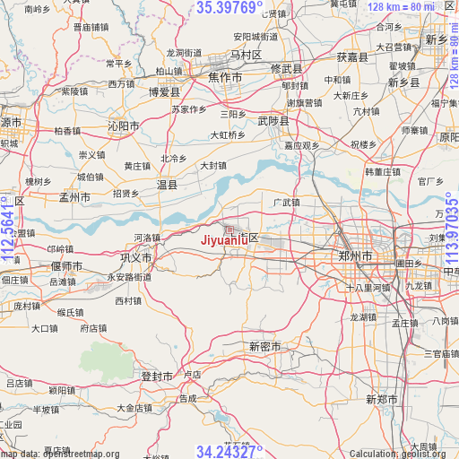
Jiyuanlu GPS coordinates[2]
34° 49' 21" North, 113° 16' 1.992" East
| Map corner | latitude | longitude |
|---|---|---|
| Upper-left | 35.39769°, | 112.5641° |
| Center: | 34.8225°, | 113.26722° |
| Lower-right: | 34.24327°, | 113.97035° |
| Map W x H: | 128.4×128.4 km | = 79.8×79.8mi |
| max Lat: | 53.31946° ⇑25.6% North |
| Jiyuanlu: | 34.8225° |
| min Lat: | ⇓74.4% South 18.22056° |
| min Long | Jiyuanlu | max Long |
| 75.07348° | 113.26722° | 134.28917° |
| W 44.2%⇐ | ⇒55.8% E |
Elevation
Elevation of Jiyuanlu is 149 m = 489 ft, and this is 335.8 m = 1102 ft below average elevation for this country.
| Max E: |
5622 m = 18445 ft | 52.1% |
| Avg. | 484.8 m = 1591 ft | |
| Jiyuanlu | 149 m = 489 ft | |
Min E: |
-3 m = -10 ft | 47.9% |
See also: China elevation on elevation.city.
Geographical zone
Jiyuanlu is located in North temperate zone (between Tropic of Cancer and the Arctic Circle). Distance of this Northern Tropic circle is 1266 km =786.7 mi to South.| Distance of | km | miles | from Jiyuanlu |
|---|---|---|---|
| North Pole | 6135.2 | 3812.2 | to North |
| Arctic Circle | 3529.3 | 2193 | to North |
| Tropic Cancer | 1266 | 786.7 | to South |
| Equator | 3871.9 | 2405.9 | to South |


Nearby cities:
15 places around Jiyuanlu: (largest is in red/bold)
• Huaihelu
36.2 km =22.5 mi,  109°
109°
• Huichang
45 km =28 mi,  281°
281°
• Jianshelu
31.9 km =19.8 mi,  103°
103°
• Jiaozuo
46.5 km =28.9 mi,  356°
356°
• Mucheng
32.4 km =20.1 mi,  20°
20°
• Qinghua
42.4 km =26.3 mi,  333°
333°
• Qingping
33.3 km =20.7 mi,  162°
162°
• Songyang
46.3 km =28.8 mi,  208°
208°
• Suohe
9.2 km =5.7 mi,  115°
115°
• Tanbei
42 km =26.1 mi,  314°
314°
• Wenquan
21.7 km =13.5 mi, 305°
• Yanshi Chengguanzhen
44.7 km =27.8 mi,  254°
254°
• Zhengzhou
35.6 km =22.1 mi, 101°
• Zhongzhan
47.6 km =29.6 mi,  348°
348°
• Zijinglu
27.9 km =17.3 mi,  255°
255°
Sources, notices
• [Note1] Compared only with cities in China existing in our database
• [Src1] Map data: © OpenStreetMap contributors (CC-BY-SA)
• [Src2] Other city data from geonames.org with taken over terms of usage.
• [Src3] Geographical zone / Annual Mean Temperature by Robert A. Rohde @ Wikipedia
