Meizhu geodata
Meizhu (Anhui) is a seat of a fourth-order administrative division; located in China in Asia/Shanghai (GMT+8) time zone. In our database, there are 1268 cities with bigger population. Compared to other cities in China, 56.7% of cities are located further ↓South; 77.1% of cities are located further ←West and 88.7% of cities have higher elevation than Meizhu. Note1


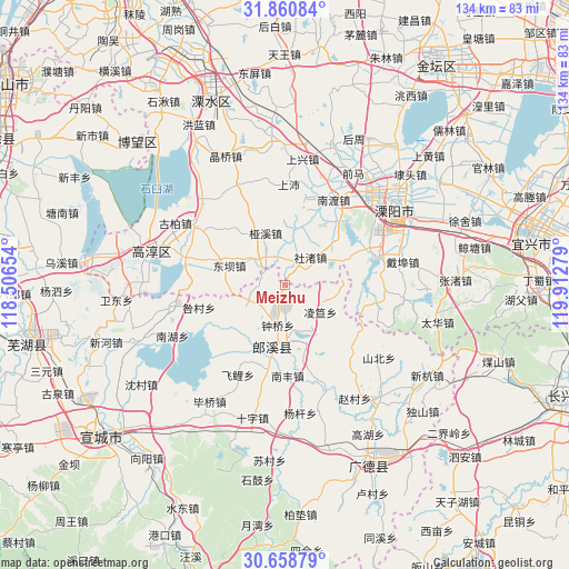
Meizhu GPS coordinates[2]
31° 15' 42.228" North, 119° 12' 34.776" East
| Map corner | latitude | longitude |
|---|---|---|
| Upper-left | 31.86084°, | 118.50654° |
| Center: | 31.26173°, | 119.20966° |
| Lower-right: | 30.65879°, | 119.91279° |
| Map W x H: | 133.7×133.7 km | = 83.1×83.1mi |
| max Lat: | 53.31946° ⇑43.3% North |
| Meizhu: | 31.26173° |
| min Lat: | ⇓56.7% South 18.22056° |
| min Long | Meizhu | max Long |
| 75.07348° | 119.20966° | 134.28917° |
| W 77.1%⇐ | ⇒22.9% E |
Elevation
Elevation of Meizhu is 11 m = 36 ft, and this is 473.8 m = 1554 ft below average elevation for this country.
| Max E: |
5622 m = 18445 ft | 88.7% |
| Avg. | 484.8 m = 1591 ft | |
| Meizhu | 11 m = 36 ft | |
Min E: |
-3 m = -10 ft | 11.3% |
See also: China elevation on elevation.city.
Geographical zone
Meizhu is located in North temperate zone (between Tropic of Cancer and the Arctic Circle). Distance of this Northern Tropic circle is 870.1 km =540.7 mi to South.| Distance of | km | miles | from Meizhu |
|---|---|---|---|
| North Pole | 6531.1 | 4058.2 | to North |
| Arctic Circle | 3925.2 | 2439 | to North |
| Tropic Cancer | 870.1 | 540.7 | to South |
| Equator | 3476 | 2159.9 | to South |


Nearby cities:
15 places around Meizhu: (largest is in red/bold)
• Dingbu
5.8 km =3.6 mi,  307°
307°
• Dongba
15.4 km =9.6 mi,  285°
285°
• Dongxia
15.4 km =9.6 mi,  227°
227°
• Gangnan
9 km =5.6 mi,  105°
105°
• Lingda
10.4 km =6.5 mi,  128°
128°
• Nandu
23 km =14.3 mi,  29°
29°
• Nanfeng
21.4 km =13.3 mi,  178°
178°
• Shezhu
8.6 km =5.3 mi,  43°
43°
• Shezhu
11.3 km =7 mi,  58°
58°
• Taocheng
18.5 km =11.5 mi,  168°
168°
• Tianmuhu
22.9 km =14.2 mi,  71°
71°
• Xinfa
12 km =7.5 mi,  237°
237°
• Yaxi
12.9 km =8 mi,  338°
338°
• Zhongqiao
9.7 km =6 mi,  190°
190°
• Zhoucheng
17.7 km =11 mi, 58°
Sources, notices
• [Note1] Compared only with cities in China existing in our database
• [Src1] Map data: © OpenStreetMap contributors (CC-BY-SA)
• [Src2] Other city data from geonames.org with taken over terms of usage.
• [Src3] Geographical zone / Annual Mean Temperature by Robert A. Rohde @ Wikipedia
