Gangnan geodata
Gangnan (Anhui) is a seat of a fourth-order administrative division; located in China in Asia/Shanghai (GMT+8) time zone. In our database, there are 1268 cities with bigger population. Compared to other cities in China, 56.6% of cities are located further ↓South; 77.6% of cities are located further ←West and 71.9% of cities have higher elevation than Gangnan. Note1


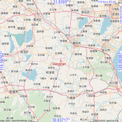
Gangnan GPS coordinates[2]
31° 14' 24.9" North, 119° 18' 2.664" East
| Map corner | latitude | longitude |
|---|---|---|
| Upper-left | 31.8395°, | 118.59762° |
| Center: | 31.24025°, | 119.30074° |
| Lower-right: | 30.63717°, | 120.00387° |
| Map W x H: | 133.7×133.7 km | = 83.1×83.1mi |
| max Lat: | 53.31946° ⇑43.4% North |
| Gangnan: | 31.24025° |
| min Lat: | ⇓56.6% South 18.22056° |
| min Long | Gangnan | max Long |
| 75.07348° | 119.30074° | 134.28917° |
| W 77.6%⇐ | ⇒22.4% E |
Elevation
Elevation of Gangnan is 45 m = 148 ft, and this is 439.8 m = 1443 ft below average elevation for this country.
| Max E: |
5622 m = 18445 ft | 71.9% |
| Avg. | 484.8 m = 1591 ft | |
| Gangnan | 45 m = 148 ft | |
Min E: |
-3 m = -10 ft | 28.1% |
See also: China elevation on elevation.city.
Geographical zone
Gangnan is located in North temperate zone (between Tropic of Cancer and the Arctic Circle). Distance of this Northern Tropic circle is 867.7 km =539.2 mi to South.| Distance of | km | miles | from Gangnan |
|---|---|---|---|
| North Pole | 6533.5 | 4059.7 | to North |
| Arctic Circle | 3927.6 | 2440.5 | to North |
| Tropic Cancer | 867.7 | 539.2 | to South |
| Equator | 3473.6 | 2158.4 | to South |


Nearby cities:
15 places around Gangnan: (largest is in red/bold)
• Daibu
20.3 km =12.6 mi,  67°
67°
• Dingbu
14.5 km =9 mi,  294°
294°
• Dongxia
21.6 km =13.4 mi,  248°
248°
• Lingda
4.1 km =2.5 mi,  186°
186°
• Meizhu
9 km =5.6 mi, 285°
• Nandu
21.9 km =13.6 mi,  18°
18°
• Nanfeng
20.7 km =12.9 mi,  203°
203°
• Shezhu
8.4 km =5.2 mi,  6°
6°
• Shezhu
9.1 km =5.7 mi,  342°
342°
• Taocheng
16.5 km =10.3 mi, 197°
• Tianmuhu
16.2 km =10.1 mi,  54°
54°
• Xinfa
19.2 km =11.9 mi,  257°
257°
• Yaxi
19.7 km =12.2 mi,  317°
317°
• Zhongqiao
12.6 km =7.8 mi,  235°
235°
• Zhoucheng
13.2 km =8.2 mi,  29°
29°
Sources, notices
• [Note1] Compared only with cities in China existing in our database
• [Src1] Map data: © OpenStreetMap contributors (CC-BY-SA)
• [Src2] Other city data from geonames.org with taken over terms of usage.
• [Src3] Geographical zone / Annual Mean Temperature by Robert A. Rohde @ Wikipedia
