Zhoucheng geodata
Zhoucheng (Jiangsu) is a seat of a fourth-order administrative division; located in China in Asia/Shanghai (GMT+8) time zone. In our database, there are 1268 cities with bigger population. Compared to other cities in China, 57.4% of cities are located further ↓South; 78% of cities are located further ←West and 88.7% of cities have higher elevation than Zhoucheng. Note1


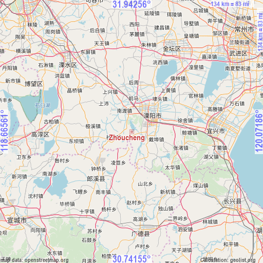
Zhoucheng GPS coordinates[2]
31° 20' 38.292" North, 119° 22' 7.428" East
| Map corner | latitude | longitude |
|---|---|---|
| Upper-left | 31.94256°, | 118.66561° |
| Center: | 31.34397°, | 119.36873° |
| Lower-right: | 30.74155°, | 120.07186° |
| Map W x H: | 133.5×133.5 km | = 83×83mi |
| max Lat: | 53.31946° ⇑42.6% North |
| Zhoucheng: | 31.34397° |
| min Lat: | ⇓57.4% South 18.22056° |
| min Long | Zhoucheng | max Long |
| 75.07348° | 119.36873° | 134.28917° |
| W 78%⇐ | ⇒22% E |
Elevation
Elevation of Zhoucheng is 11 m = 36 ft, and this is 473.8 m = 1554 ft below average elevation for this country.
| Max E: |
5622 m = 18445 ft | 88.7% |
| Avg. | 484.8 m = 1591 ft | |
| Zhoucheng | 11 m = 36 ft | |
Min E: |
-3 m = -10 ft | 11.3% |
See also: China elevation on elevation.city.
Geographical zone
Zhoucheng is located in North temperate zone (between Tropic of Cancer and the Arctic Circle). Distance of this Northern Tropic circle is 879.2 km =546.3 mi to South.| Distance of | km | miles | from Zhoucheng |
|---|---|---|---|
| North Pole | 6521.9 | 4052.5 | to North |
| Arctic Circle | 3916.1 | 2433.4 | to North |
| Tropic Cancer | 879.2 | 546.3 | to South |
| Equator | 3485.1 | 2165.5 | to South |


Nearby cities:
15 places around Zhoucheng: (largest is in red/bold)
• Daibu
12.7 km =7.9 mi,  106°
106°
• Dingbu
20.5 km =12.7 mi,  254°
254°
• Gangnan
13.2 km =8.2 mi,  209°
209°
• Licheng
14.4 km =8.9 mi,  49°
49°
• Lingda
17 km =10.6 mi,  203°
203°
• Meizhu
17.7 km =11 mi,  238°
238°
• Nandu
9.3 km =5.8 mi,  2°
2°
• Nandu
11.5 km =7.1 mi,  340°
340°
• Shangpei
20.4 km =12.7 mi,  315°
315°
• Shangxing
19.9 km =12.4 mi, 336°
• Shezhu
6.4 km =4 mi, 240°
• Shezhu
9.6 km =6 mi, 252°
• Tianmuhu
7 km =4.3 mi, 106°
• Xizhu
19.8 km =12.3 mi, 107°
• Yaxi
20 km =12.4 mi,  278°
278°
Sources, notices
• [Note1] Compared only with cities in China existing in our database
• [Src1] Map data: © OpenStreetMap contributors (CC-BY-SA)
• [Src2] Other city data from geonames.org with taken over terms of usage.
• [Src3] Geographical zone / Annual Mean Temperature by Robert A. Rohde @ Wikipedia
