Maotian geodata
Maotian (Hubei) is a seat of a fourth-order administrative division; located in China in Asia/Shanghai (GMT+8) time zone. In our database, there are 1268 cities with bigger population. Compared to other cities in China, 52.9% of cities are located further ↓South; 71.8% of cities are located further →East and 88.8% of cities have lower elevation than Maotian. Note1


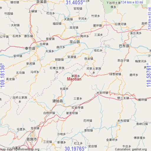
Maotian GPS coordinates[2]
30° 48' 12.492" North, 109° 53' 4.128" East
| Map corner | latitude | longitude |
|---|---|---|
| Upper-left | 31.4055°, | 109.18136° |
| Center: | 30.80347°, | 109.88448° |
| Lower-right: | 30.19765°, | 110.58761° |
| Map W x H: | 134.3×134.3 km | = 83.5×83.5mi |
| max Lat: | 53.31946° ⇑47.1% North |
| Maotian: | 30.80347° |
| min Lat: | ⇓52.9% South 18.22056° |
| min Long | Maotian | max Long |
| 75.07348° | 109.88448° | 134.28917° |
| W 28.2%⇐ | ⇒71.8% E |
Elevation
Elevation of Maotian is 1251 m = 4104 ft, and this is 766.2 m = 2514 ft above average elevation for this country.
| Max E: |
5622 m = 18445 ft | 11.2% |
| Maotian | 1251 m 4104 ft | |
| Avg. | 484.8 m = 1591 ft | |
Min E: |
-3 m = -10 ft | 88.8% |
See also: China elevation on elevation.city.
Geographical zone
Maotian is located in North temperate zone (between Tropic of Cancer and the Arctic Circle). Distance of this Northern Tropic circle is 819.1 km =509 mi to South.| Distance of | km | miles | from Maotian |
|---|---|---|---|
| North Pole | 6582 | 4089.9 | to North |
| Arctic Circle | 3976.1 | 2470.6 | to North |
| Tropic Cancer | 819.1 | 509 | to South |
| Equator | 3425 | 2128.2 | to South |


Nearby cities:
15 places around Maotian: (largest is in red/bold)
• Baolong
19.3 km =12 mi,  36°
36°
• Changliang
15.2 km =9.4 mi,  222°
222°
• Dazhiping
28 km =17.4 mi,  122°
122°
• Duping
25.3 km =15.7 mi,  55°
55°
• Gaoping
24.3 km =15.1 mi,  129°
129°
• Guandu
17.3 km =10.7 mi,  348°
348°
• Heshuiping
25.2 km =15.7 mi,  186°
186°
• Hongchun
17.3 km =10.7 mi,  288°
288°
• Hongyansi
28.2 km =17.5 mi,  176°
176°
• Jianping
27.1 km =16.8 mi,  8°
8°
• Longping
25.3 km =15.7 mi,  87°
87°
• Miaoyu
23.9 km =14.9 mi, 287°
• Sanli
20.1 km =12.5 mi,  174°
174°
• Tonggu
20.6 km =12.8 mi,  314°
314°
• Yezhou
27 km =16.8 mi,  214°
214°
Sources, notices
• [Note1] Compared only with cities in China existing in our database
• [Src1] Map data: © OpenStreetMap contributors (CC-BY-SA)
• [Src2] Other city data from geonames.org with taken over terms of usage.
• [Src3] Geographical zone / Annual Mean Temperature by Robert A. Rohde @ Wikipedia
