Yezhou geodata
Yezhou (Hubei) is a seat of a third-order administrative division; located in China in Asia/Shanghai (GMT+8) time zone. In our database, there are 1268 cities with bigger population. Compared to other cities in China, 51.2% of cities are located further ↓South; 72.7% of cities are located further →East and 76.4% of cities have lower elevation than Yezhou. Note1


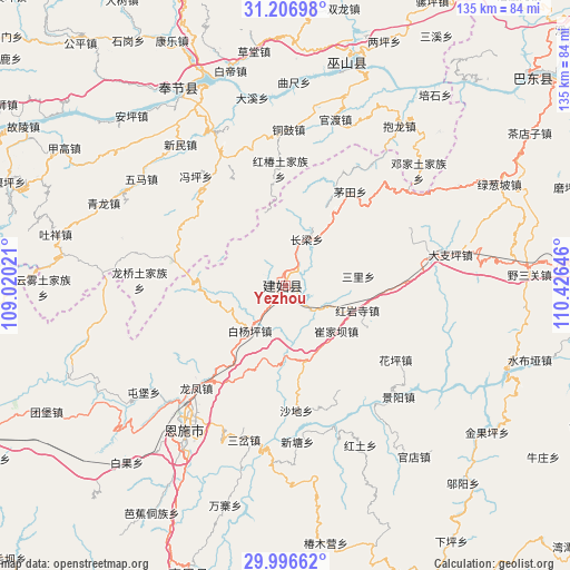
Yezhou GPS coordinates[2]
30° 36' 13.284" North, 109° 43' 23.988" East
| Map corner | latitude | longitude |
|---|---|---|
| Upper-left | 31.20698°, | 109.02021° |
| Center: | 30.60369°, | 109.72333° |
| Lower-right: | 29.99662°, | 110.42646° |
| Map W x H: | 134.6×134.6 km | = 83.6×83.6mi |
| max Lat: | 53.31946° ⇑48.8% North |
| Yezhou: | 30.60369° |
| min Lat: | ⇓51.2% South 18.22056° |
| min Long | Yezhou | max Long |
| 75.07348° | 109.72333° | 134.28917° |
| W 27.3%⇐ | ⇒72.7% E |
Elevation
Elevation of Yezhou is 557 m = 1827 ft, and this is 72.2 m = 237 ft above average elevation for this country.
| Max E: |
5622 m = 18445 ft | 23.6% |
| Yezhou | 557 m 1827 ft | |
| Avg. | 484.8 m = 1591 ft | |
Min E: |
-3 m = -10 ft | 76.4% |
See also: China elevation on elevation.city.
Geographical zone
Yezhou is located in North temperate zone (between Tropic of Cancer and the Arctic Circle). Distance of this Northern Tropic circle is 796.9 km =495.2 mi to South.| Distance of | km | miles | from Yezhou |
|---|---|---|---|
| North Pole | 6604.3 | 4103.7 | to North |
| Arctic Circle | 3998.4 | 2484.5 | to North |
| Tropic Cancer | 796.9 | 495.2 | to South |
| Equator | 3402.8 | 2114.4 | to South |


Nearby cities:
15 places around Yezhou: (largest is in red/bold)
• Baiyangping
14.5 km =9 mi,  214°
214°
• Changliang
12.1 km =7.5 mi,  25°
25°
• Chang’an
29.8 km =18.5 mi,  327°
327°
• Cuijiaba
16.2 km =10.1 mi,  131°
131°
• Heshuiping
12.7 km =7.9 mi,  102°
102°
• Hongchun
27.7 km =17.2 mi,  357°
357°
• Hongyansi
18.2 km =11.3 mi,  109°
109°
• Huaping
31 km =19.3 mi, 125°
• Longfengba
31.7 km =19.7 mi,  220°
220°
• Maotian
27 km =16.8 mi, 34°
• Miaoyu
30.4 km =18.9 mi,  345°
345°
• Sanli
17.5 km =10.9 mi,  82°
82°
• Shadi
29.7 km =18.5 mi,  174°
174°
• Taiyanghe
20.1 km =12.5 mi,  268°
268°
• Xinglong
27.2 km =16.9 mi,  282°
282°
Sources, notices
• [Note1] Compared only with cities in China existing in our database
• [Src1] Map data: © OpenStreetMap contributors (CC-BY-SA)
• [Src2] Other city data from geonames.org with taken over terms of usage.
• [Src3] Geographical zone / Annual Mean Temperature by Robert A. Rohde @ Wikipedia
