Longping geodata
Longping (Hubei) is a seat of a fourth-order administrative division; located in China in Asia/Shanghai (GMT+8) time zone. In our database, there are 1268 cities with bigger population. Compared to other cities in China, 53% of cities are located further ↓South; 70.6% of cities are located further →East and 91.3% of cities have lower elevation than Longping. Note1


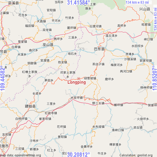
Longping GPS coordinates[2]
30° 48' 49.968" North, 110° 8' 56.184" East
| Map corner | latitude | longitude |
|---|---|---|
| Upper-left | 31.41584°, | 109.44582° |
| Center: | 30.81388°, | 110.14894° |
| Lower-right: | 30.20812°, | 110.85207° |
| Map W x H: | 134.3×134.3 km | = 83.5×83.5mi |
| max Lat: | 53.31946° ⇑47% North |
| Longping: | 30.81388° |
| min Lat: | ⇓53% South 18.22056° |
| min Long | Longping | max Long |
| 75.07348° | 110.14894° | 134.28917° |
| W 29.4%⇐ | ⇒70.6% E |
Elevation
Elevation of Longping is 1488 m = 4882 ft, and this is 1003.2 m = 3291 ft above average elevation for this country.
| Max E: |
5622 m = 18445 ft | 8.7% |
| Longping | 1488 m 4882 ft | |
| Avg. | 484.8 m = 1591 ft | |
Min E: |
-3 m = -10 ft | 91.3% |
See also: China elevation on elevation.city.
Geographical zone
Longping is located in North temperate zone (between Tropic of Cancer and the Arctic Circle). Distance of this Northern Tropic circle is 820.3 km =509.7 mi to South.| Distance of | km | miles | from Longping |
|---|---|---|---|
| North Pole | 6580.9 | 4089.2 | to North |
| Arctic Circle | 3975 | 2469.9 | to North |
| Tropic Cancer | 820.3 | 509.7 | to South |
| Equator | 3426.2 | 2128.9 | to South |


Nearby cities:
15 places around Longping: (largest is in red/bold)
• Baolong
19.8 km =12.3 mi,  316°
316°
• Chadianzi
21.2 km =13.2 mi,  53°
53°
• Dazhiping
16.1 km =10 mi,  185°
185°
• Duping
13.7 km =8.5 mi,  341°
341°
• Gaoping
18 km =11.2 mi,  201°
201°
• Guandu
32.9 km =20.4 mi,  298°
298°
• Guandukou
29.3 km =18.2 mi,  31°
31°
• Jianping
33.4 km =20.8 mi, 320°
• Lücongpo
9.9 km =6.2 mi,  86°
86°
• Maotian
25.3 km =15.7 mi,  267°
267°
• Meijiahe
34.2 km =21.3 mi,  69°
69°
• Moping
26.5 km =16.5 mi, 90°
• Sanli
31.5 km =19.6 mi,  227°
227°
• Xinling
28.5 km =17.7 mi, 34°
• Yesanguan
27.4 km =17 mi,  142°
142°
Sources, notices
• [Note1] Compared only with cities in China existing in our database
• [Src1] Map data: © OpenStreetMap contributors (CC-BY-SA)
• [Src2] Other city data from geonames.org with taken over terms of usage.
• [Src3] Geographical zone / Annual Mean Temperature by Robert A. Rohde @ Wikipedia
