Majing’ao geodata
Majing’ao (Hunan) is a seat of a fourth-order administrative division; located in China in Asia/Shanghai (GMT+8) time zone. In our database, there are 1268 cities with bigger population. Compared to other cities in China, 70.5% of cities are located further ↑North; 72.3% of cities are located further →East and 57.2% of cities have lower elevation than Majing’ao. Note1


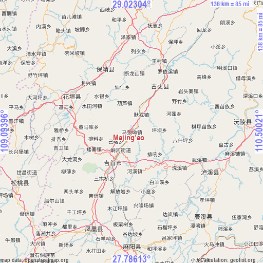
Majing’ao GPS coordinates[2]
28° 24' 23.004" North, 109° 47' 49.488" East
| Map corner | latitude | longitude |
|---|---|---|
| Upper-left | 29.02304°, | 109.09396° |
| Center: | 28.40639°, | 109.79708° |
| Lower-right: | 27.78613°, | 110.50021° |
| Map W x H: | 137.5×137.5 km | = 85.4×85.4mi |
| max Lat: | 53.31946° ⇑70.5% North |
| Majing’ao: | 28.40639° |
| min Lat: | ⇓29.5% South 18.22056° |
| min Long | Majing’ao | max Long |
| 75.07348° | 109.79708° | 134.28917° |
| W 27.7%⇐ | ⇒72.3% E |
Elevation
Elevation of Majing’ao is 227 m = 745 ft, and this is 257.8 m = 846 ft below average elevation for this country.
| Max E: |
5622 m = 18445 ft | 42.8% |
| Avg. | 484.8 m = 1591 ft | |
| Majing’ao | 227 m = 745 ft | |
Min E: |
-3 m = -10 ft | 57.2% |
See also: China elevation on elevation.city.
Geographical zone
Majing’ao is located in North temperate zone (between Tropic of Cancer and the Arctic Circle). Distance of this Northern Tropic circle is 552.6 km =343.4 mi to South.| Distance of | km | miles | from Majing’ao |
|---|---|---|---|
| North Pole | 6848.6 | 4255.5 | to North |
| Arctic Circle | 4242.7 | 2636.3 | to North |
| Tropic Cancer | 552.6 | 343.4 | to South |
| Equator | 3158.5 | 1962.6 | to South |


Nearby cities:
15 places around Majing’ao: (largest is in red/bold)
• Aizhai
21.7 km =13.5 mi,  245°
245°
• Baiyan
5.6 km =3.5 mi,  71°
71°
• Baiyan
18.1 km =11.2 mi,  106°
106°
• Dehang
11 km =6.8 mi,  180°
180°
• Hexi
20.4 km =12.7 mi, 175°
• Hulu
15.7 km =9.8 mi,  345°
345°
• Jilue
9.8 km =6.1 mi,  240°
240°
• Morong
10.4 km =6.5 mi,  28°
28°
• Pailiao
19.2 km =11.9 mi,  259°
259°
• Pingba
14 km =8.7 mi,  88°
88°
• Qianzhou
11.5 km =7.1 mi,  212°
212°
• Taiping
10.6 km =6.6 mi,  156°
156°
• Tanxi
21.6 km =13.4 mi,  136°
136°
• Wanrongjiang
19.5 km =12.1 mi, 211°
• Zhaiyang
17.7 km =11 mi,  232°
232°
Sources, notices
• [Note1] Compared only with cities in China existing in our database
• [Src1] Map data: © OpenStreetMap contributors (CC-BY-SA)
• [Src2] Other city data from geonames.org with taken over terms of usage.
• [Src3] Geographical zone / Annual Mean Temperature by Robert A. Rohde @ Wikipedia
