Madaotou geodata
Madaotou (Shanxi) is a seat of a fourth-order administrative division; located in China in Asia/Shanghai (GMT+8) time zone. In our database, there are 1268 cities with bigger population. Compared to other cities in China, 86% of cities are located further ↓South; 58.8% of cities are located further →East and 91.7% of cities have lower elevation than Madaotou. Note1


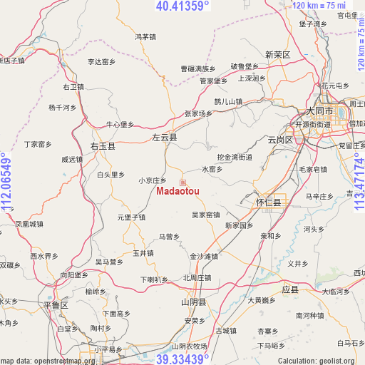
Madaotou GPS coordinates[2]
39° 52' 33.996" North, 112° 46' 6.996" East
| Map corner | latitude | longitude |
|---|---|---|
| Upper-left | 40.41359°, | 112.06549° |
| Center: | 39.87611°, | 112.76861° |
| Lower-right: | 39.33439°, | 113.47174° |
| Map W x H: | 120×120 km | = 74.6×74.6mi |
| max Lat: | 53.31946° ⇑14% North |
| Madaotou: | 39.87611° |
| min Lat: | ⇓86% South 18.22056° |
| min Long | Madaotou | max Long |
| 75.07348° | 112.76861° | 134.28917° |
| W 41.2%⇐ | ⇒58.8% E |
Elevation
Elevation of Madaotou is 1540 m = 5052 ft, and this is 1055.2 m = 3462 ft above average elevation for this country.
| Max E: |
5622 m = 18445 ft | 8.3% |
| Madaotou | 1540 m 5052 ft | |
| Avg. | 484.8 m = 1591 ft | |
Min E: |
-3 m = -10 ft | 91.7% |
See also: China elevation on elevation.city.
Geographical zone
Madaotou is located in North temperate zone (between Tropic of Cancer and the Arctic Circle). Distance of this Northern Tropic circle is 1827.9 km =1135.8 mi to South.| Distance of | km | miles | from Madaotou |
|---|---|---|---|
| North Pole | 5573.3 | 3463.1 | to North |
| Arctic Circle | 2967.4 | 1843.9 | to North |
| Tropic Cancer | 1827.9 | 1135.8 | to South |
| Equator | 4433.8 | 2755 | to South |


Nearby cities:
15 places around Madaotou: (largest is in red/bold)
• Baitouli
23.8 km =14.8 mi,  277°
277°
• Dianwan
14.8 km =9.2 mi,  33°
33°
• Hejiabao
24.9 km =15.5 mi,  106°
106°
• Maying
17.9 km =11.1 mi,  194°
194°
• Santun
25.3 km =15.7 mi,  349°
349°
• Shuiyao
10.1 km =6.3 mi,  70°
70°
• Wujiayao
12.7 km =7.9 mi,  143°
143°
• Xiaojingzhuang
10 km =6.2 mi, 276°
• Xinjiayuan
23 km =14.3 mi,  126°
126°
• Ya’erya
21.7 km =13.5 mi,  61°
61°
• Yuanbuzi
20.9 km =13 mi,  253°
253°
• Yujing
26.4 km =16.4 mi,  212°
212°
• Yunxing
14.9 km =9.3 mi,  336°
336°
• Yunzhong
28.5 km =17.7 mi,  101°
101°
• Zhangjiachang
23.7 km =14.7 mi,  13°
13°
Sources, notices
• [Note1] Compared only with cities in China existing in our database
• [Src1] Map data: © OpenStreetMap contributors (CC-BY-SA)
• [Src2] Other city data from geonames.org with taken over terms of usage.
• [Src3] Geographical zone / Annual Mean Temperature by Robert A. Rohde @ Wikipedia
