Lüshun geodata
Lüshun (Liaoning) is a populated place; located in China in Asia/Shanghai (GMT+8) time zone. With population of 82,345 people, there are 521 cities with bigger population in this country. Compared to other cities in China, 82.3% of cities are located further ↓South; 88.9% of cities are located further ←West and 98.3% of cities have higher elevation than Lüshun. Note1


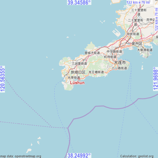
Lüshun GPS coordinates[2]
38° 48' 0" North, 121° 16' 0.012" East
| Map corner | latitude | longitude |
|---|---|---|
| Upper-left | 39.34586°, | 120.56355° |
| Center: | 38.8°, | 121.26667° |
| Lower-right: | 38.24992°, | 121.9698° |
| Map W x H: | 121.9×121.9 km | = 75.7×75.7mi |
| max Lat: | 53.31946° ⇑17.7% North |
| Lüshun: | 38.8° |
| min Lat: | ⇓82.3% South 18.22056° |
| min Long | Lüshun | max Long |
| 75.07348° | 121.26667° | 134.28917° |
| W 88.9%⇐ | ⇒11.1% E |
Elevation
Elevation of Lüshun is 4 m = 13 ft, and this is 480.8 m = 1577 ft below average elevation for this country.
| Max E: |
5622 m = 18445 ft | 98.3% |
| Avg. | 484.8 m = 1591 ft | |
| Lüshun | 4 m = 13 ft | |
Min E: |
-3 m = -10 ft | 1.7% |
See also: Lüshun elevation on elevation.city.
Geographical zone
Lüshun is located in North temperate zone (between Tropic of Cancer and the Arctic Circle). Distance of this Northern Tropic circle is 1708.2 km =1061.4 mi to South.| Distance of | km | miles | from Lüshun |
|---|---|---|---|
| North Pole | 5692.9 | 3537.4 | to North |
| Arctic Circle | 3087 | 1918.2 | to North |
| Tropic Cancer | 1708.2 | 1061.4 | to South |
| Equator | 4314.2 | 2680.7 | to South |


Nearby cities:
15 places around Lüshun: (largest is in red/bold)
• Beichangshan
104.2 km =64.7 mi,  207°
207°
• Chaoshui
125.8 km =78.2 mi,  191°
191°
• Dachang Shandao
126.7 km =78.7 mi,  65°
65°
• Dalian
31.6 km =19.6 mi, 66°
• Dalianwan
44.9 km =27.9 mi,  55°
55°
• Dengzhou
118.8 km =73.8 mi,  201°
201°
• Heishan
108.6 km =67.5 mi, 211°
• Jinzhou
51.3 km =31.9 mi,  49°
49°
• Liujiagou
119.7 km =74.4 mi, 196°
• Nanchangshan
107.4 km =66.7 mi, 205°
• Nanchangshan
108.8 km =67.6 mi, 205°
• Nanwang
122.5 km =76.1 mi, 199°
• Pulandian
89.6 km =55.7 mi,  42°
42°
• Wafangdian
111.2 km =69.1 mi, 35°
• Xingang
117 km =72.7 mi, 197°
In other languages:
- In Spanish: Port Arthur
- In German: Lüshunkou
- In Italian: Port Arthur
- In Russian: Порт-Артур
- In Chinese: 旅顺口区
Sources, notices
• [Note1] Compared only with cities in China existing in our database
• [Src1] Map data: © OpenStreetMap contributors (CC-BY-SA)
• [Src2] Other city data from geonames.org with taken over terms of usage.
• [Src3] Geographical zone / Annual Mean Temperature by Robert A. Rohde @ Wikipedia
