Lishan geodata
Lishan (Hubei) is a seat of a third-order administrative division; located in China in Asia/Shanghai (GMT+8) time zone. In our database, there are 1268 cities with bigger population. Compared to other cities in China, 60.3% of cities are located further ↓South; 55.6% of cities are located further →East and 62.4% of cities have higher elevation than Lishan. Note1


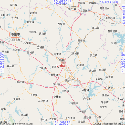
Lishan GPS coordinates[2]
31° 51' 27.504" North, 113° 17' 42.18" East
| Map corner | latitude | longitude |
|---|---|---|
| Upper-left | 32.45291°, | 112.59193° |
| Center: | 31.85764°, | 113.29505° |
| Lower-right: | 31.2585°, | 113.99818° |
| Map W x H: | 132.8×132.8 km | = 82.5×82.5mi |
| max Lat: | 53.31946° ⇑39.7% North |
| Lishan: | 31.85764° |
| min Lat: | ⇓60.3% South 18.22056° |
| min Long | Lishan | max Long |
| 75.07348° | 113.29505° | 134.28917° |
| W 44.4%⇐ | ⇒55.6% E |
Elevation
Elevation of Lishan is 85 m = 279 ft, and this is 399.8 m = 1312 ft below average elevation for this country.
| Max E: |
5622 m = 18445 ft | 62.4% |
| Avg. | 484.8 m = 1591 ft | |
| Lishan | 85 m = 279 ft | |
Min E: |
-3 m = -10 ft | 37.6% |
See also: China elevation on elevation.city.
Geographical zone
Lishan is located in North temperate zone (between Tropic of Cancer and the Arctic Circle). Distance of this Northern Tropic circle is 936.3 km =581.8 mi to South.| Distance of | km | miles | from Lishan |
|---|---|---|---|
| North Pole | 6464.8 | 4017 | to North |
| Arctic Circle | 3858.9 | 2397.8 | to North |
| Tropic Cancer | 936.3 | 581.8 | to South |
| Equator | 3542.2 | 2201 | to South |


Nearby cities:
15 places around Lishan: (largest is in red/bold)
• Anju
15.4 km =9.6 mi,  215°
215°
• Dayanpo
30.8 km =19.1 mi,  154°
154°
• Fengjiang
13.5 km =8.4 mi,  17°
17°
• Fujia
31.6 km =19.6 mi,  352°
352°
• Gaocheng
17.1 km =10.6 mi,  54°
54°
• Hedian
29.5 km =18.3 mi,  175°
175°
• Junchuan
24 km =14.9 mi,  197°
197°
• Nanjiao
16.9 km =10.5 mi,  162°
162°
• Shangshi
11.1 km =6.9 mi,  327°
327°
• Suizhou
17.5 km =10.9 mi, 158°
• Tangxian
21.8 km =13.5 mi,  308°
308°
• Wandian
18.8 km =11.7 mi,  98°
98°
• Xihe
25 km =15.5 mi,  139°
139°
• Xinjie
9 km =5.6 mi,  241°
241°
• Yindian
31 km =19.3 mi,  39°
39°
Sources, notices
• [Note1] Compared only with cities in China existing in our database
• [Src1] Map data: © OpenStreetMap contributors (CC-BY-SA)
• [Src2] Other city data from geonames.org with taken over terms of usage.
• [Src3] Geographical zone / Annual Mean Temperature by Robert A. Rohde @ Wikipedia
