Lihen geodata
Lihen (Anhui) is a seat of a fourth-order administrative division; located in China in Asia/Shanghai (GMT+8) time zone. In our database, there are 1268 cities with bigger population. Compared to other cities in China, 56.8% of cities are located further ↑North; 65.9% of cities are located further ←West and 60.4% of cities have higher elevation than Lihen. Note1


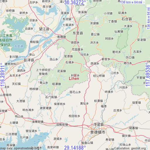
Lihen GPS coordinates[2]
29° 45' 14.976" North, 116° 59' 32.028" East
| Map corner | latitude | longitude |
|---|---|---|
| Upper-left | 30.36272°, | 116.28911° |
| Center: | 29.75416°, | 116.99223° |
| Lower-right: | 29.14188°, | 117.69536° |
| Map W x H: | 135.7×135.7 km | = 84.3×84.3mi |
| max Lat: | 53.31946° ⇑56.8% North |
| Lihen: | 29.75416° |
| min Lat: | ⇓43.2% South 18.22056° |
| min Long | Lihen | max Long |
| 75.07348° | 116.99223° | 134.28917° |
| W 65.9%⇐ | ⇒34.1% E |
Elevation
Elevation of Lihen is 96 m = 315 ft, and this is 388.8 m = 1276 ft below average elevation for this country.
| Max E: |
5622 m = 18445 ft | 60.4% |
| Avg. | 484.8 m = 1591 ft | |
| Lihen | 96 m = 315 ft | |
Min E: |
-3 m = -10 ft | 39.6% |
See also: China elevation on elevation.city.
Geographical zone
Lihen is located in North temperate zone (between Tropic of Cancer and the Arctic Circle). Distance of this Northern Tropic circle is 702.4 km =436.5 mi to South.| Distance of | km | miles | from Lihen |
|---|---|---|---|
| North Pole | 6698.7 | 4162.4 | to North |
| Arctic Circle | 4092.8 | 2543.1 | to North |
| Tropic Cancer | 702.4 | 436.5 | to South |
| Equator | 3308.4 | 2055.7 | to South |


Nearby cities:
15 places around Lihen: (largest is in red/bold)
• Dongsheng
29.9 km =18.6 mi,  286°
286°
• Guangang
18.6 km =11.6 mi,  340°
340°
• Haoshan
24.3 km =15.1 mi,  306°
306°
• Houjiagang
29.2 km =18.1 mi,  208°
208°
• Huangtan
27.1 km =16.8 mi,  162°
162°
• Huayuanli
23.5 km =14.6 mi,  5°
5°
• Jinggongqiao
21.4 km =13.3 mi,  91°
91°
• Lianhuashan
15.1 km =9.4 mi,  179°
179°
• Longquan
21.4 km =13.3 mi,  233°
233°
• Makeng
21 km =13 mi,  25°
25°
• Muta
6.1 km =3.8 mi,  66°
66°
• Nixi
13.1 km =8.1 mi, 288°
• Qingshan
29.2 km =18.1 mi,  256°
256°
• Shimenjie
29.3 km =18.2 mi, 227°
• Xihu
20.9 km =13 mi,  59°
59°
Sources, notices
• [Note1] Compared only with cities in China existing in our database
• [Src1] Map data: © OpenStreetMap contributors (CC-BY-SA)
• [Src2] Other city data from geonames.org with taken over terms of usage.
• [Src3] Geographical zone / Annual Mean Temperature by Robert A. Rohde @ Wikipedia
