Huangtan geodata
Huangtan (Jiangxi) is a seat of a fourth-order administrative division; located in China in Asia/Shanghai (GMT+8) time zone. In our database, there are 1268 cities with bigger population. Compared to other cities in China, 59.5% of cities are located further ↑North; 66.4% of cities are located further ←West and 64.1% of cities have higher elevation than Huangtan. Note1


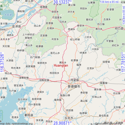
Huangtan GPS coordinates[2]
29° 31' 20.604" North, 117° 4' 42.168" East
| Map corner | latitude | longitude |
|---|---|---|
| Upper-left | 30.13237°, | 116.37526° |
| Center: | 29.52239°, | 117.07838° |
| Lower-right: | 28.90871°, | 117.78151° |
| Map W x H: | 136.1×136.1 km | = 84.6×84.6mi |
| max Lat: | 53.31946° ⇑59.5% North |
| Huangtan: | 29.52239° |
| min Lat: | ⇓40.5% South 18.22056° |
| min Long | Huangtan | max Long |
| 75.07348° | 117.07838° | 134.28917° |
| W 66.4%⇐ | ⇒33.6% E |
Elevation
Elevation of Huangtan is 77 m = 253 ft, and this is 407.8 m = 1338 ft below average elevation for this country.
| Max E: |
5622 m = 18445 ft | 64.1% |
| Avg. | 484.8 m = 1591 ft | |
| Huangtan | 77 m = 253 ft | |
Min E: |
-3 m = -10 ft | 35.9% |
See also: China elevation on elevation.city.
Geographical zone
Huangtan is located in North temperate zone (between Tropic of Cancer and the Arctic Circle). Distance of this Northern Tropic circle is 676.7 km =420.5 mi to South.| Distance of | km | miles | from Huangtan |
|---|---|---|---|
| North Pole | 6724.5 | 4178.4 | to North |
| Arctic Circle | 4118.6 | 2559.2 | to North |
| Tropic Cancer | 676.7 | 420.5 | to South |
| Equator | 3282.6 | 2039.7 | to South |


Nearby cities:
15 places around Huangtan: (largest is in red/bold)
• Fuliang
23 km =14.3 mi,  134°
134°
• Hongyuan
23.4 km =14.5 mi,  162°
162°
• Houjiagang
22.4 km =13.9 mi,  270°
270°
• Jiantianjie
14.2 km =8.8 mi,  219°
219°
• Jiaotan
13.3 km =8.3 mi,  76°
76°
• Jingdezhen
28.3 km =17.6 mi,  153°
153°
• Jinggongqiao
28.3 km =17.6 mi,  27°
27°
• Jinpanling
22.3 km =13.9 mi,  201°
201°
• Lianhuashan
13.5 km =8.4 mi,  322°
322°
• Lihen
27.1 km =16.8 mi,  342°
342°
• Longquan
28.8 km =17.9 mi,  297°
297°
• Muta
28.3 km =17.6 mi,  354°
354°
• Sanlong
16.6 km =10.3 mi, 157°
• Wanggang
27.2 km =16.9 mi,  123°
123°
• Zhitan
24.8 km =15.4 mi,  63°
63°
Sources, notices
• [Note1] Compared only with cities in China existing in our database
• [Src1] Map data: © OpenStreetMap contributors (CC-BY-SA)
• [Src2] Other city data from geonames.org with taken over terms of usage.
• [Src3] Geographical zone / Annual Mean Temperature by Robert A. Rohde @ Wikipedia
