Jingtou geodata
Jingtou (Guangdong) is a seat of a fourth-order administrative division; located in China in Asia/Shanghai (GMT+8) time zone. In our database, there are 1268 cities with bigger population. Compared to other cities in China, 90.5% of cities are located further ↑North; 53.2% of cities are located further →East and 57.2% of cities have higher elevation than Jingtou. Note1


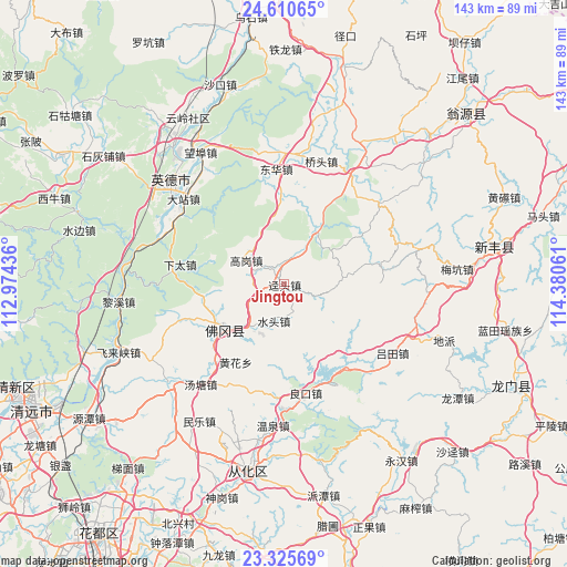
Jingtou GPS coordinates[2]
23° 58' 11.172" North, 113° 40' 38.928" East
| Map corner | latitude | longitude |
|---|---|---|
| Upper-left | 24.61065°, | 112.97436° |
| Center: | 23.96977°, | 113.67748° |
| Lower-right: | 23.32569°, | 114.38061° |
| Map W x H: | 142.9×142.9 km | = 88.8×88.8mi |
| max Lat: | 53.31946° ⇑90.5% North |
| Jingtou: | 23.96977° |
| min Lat: | ⇓9.5% South 18.22056° |
| min Long | Jingtou | max Long |
| 75.07348° | 113.67748° | 134.28917° |
| W 46.8%⇐ | ⇒53.2% E |
Elevation
Elevation of Jingtou is 116 m = 381 ft, and this is 368.8 m = 1210 ft below average elevation for this country.
| Max E: |
5622 m = 18445 ft | 57.2% |
| Avg. | 484.8 m = 1591 ft | |
| Jingtou | 116 m = 381 ft | |
Min E: |
-3 m = -10 ft | 42.8% |
See also: China elevation on elevation.city.
Geographical zone
Jingtou is located in North temperate zone (between Tropic of Cancer and the Arctic Circle). Distance of this Northern Tropic circle is 59.3 km =36.8 mi to South.| Distance of | km | miles | from Jingtou |
|---|---|---|---|
| North Pole | 7341.9 | 4562 | to North |
| Arctic Circle | 4736 | 2942.8 | to North |
| Tropic Cancer | 59.3 | 36.8 | to South |
| Equator | 2665.2 | 1656.1 | to South |


Nearby cities:
15 places around Jingtou: (largest is in red/bold)
• Baisha
15.6 km =9.7 mi,  30°
30°
• Donghua
29.1 km =18.1 mi,  357°
357°
• Gaogang
11.4 km =7.1 mi,  299°
299°
• Huanggang
25.7 km =16 mi,  315°
315°
• Liangkou
28 km =17.4 mi,  168°
168°
• Lütian
32.3 km =20.1 mi,  123°
123°
• Qingtang
32.1 km =19.9 mi, 31°
• Shatian
25.9 km =16.1 mi,  86°
86°
• Shijiao
18.8 km =11.7 mi,  233°
233°
• Shuitou
9.7 km =6 mi,  195°
195°
• Xianggui
14.8 km =9.2 mi, 34°
• Xiashitai
26.5 km =16.5 mi,  282°
282°
• Yaotian
15.2 km =9.4 mi,  84°
84°
• Yinghua
28.5 km =17.7 mi, 357°
• Yuwan
21.6 km =13.4 mi, 356°
Sources, notices
• [Note1] Compared only with cities in China existing in our database
• [Src1] Map data: © OpenStreetMap contributors (CC-BY-SA)
• [Src2] Other city data from geonames.org with taken over terms of usage.
• [Src3] Geographical zone / Annual Mean Temperature by Robert A. Rohde @ Wikipedia
