Jiaotan geodata
Jiaotan (Jiangxi) is a seat of a fourth-order administrative division; located in China in Asia/Shanghai (GMT+8) time zone. In our database, there are 1268 cities with bigger population. Compared to other cities in China, 59.2% of cities are located further ↑North; 67.3% of cities are located further ←West and 68.7% of cities have higher elevation than Jiaotan. Note1


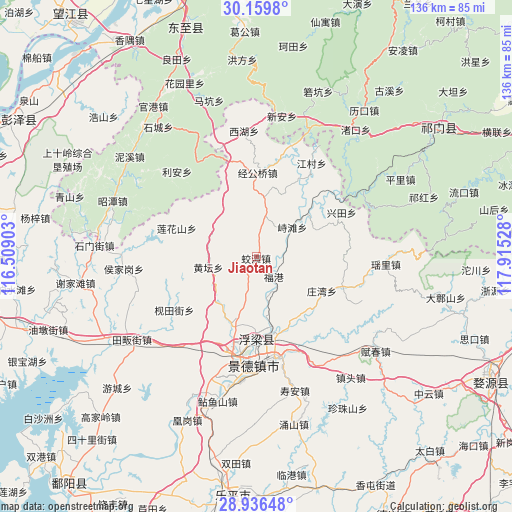
Jiaotan GPS coordinates[2]
29° 32' 59.964" North, 117° 12' 43.74" East
| Map corner | latitude | longitude |
|---|---|---|
| Upper-left | 30.1598°, | 116.50903° |
| Center: | 29.54999°, | 117.21215° |
| Lower-right: | 28.93648°, | 117.91528° |
| Map W x H: | 136×136 km | = 84.5×84.5mi |
| max Lat: | 53.31946° ⇑59.2% North |
| Jiaotan: | 29.54999° |
| min Lat: | ⇓40.8% South 18.22056° |
| min Long | Jiaotan | max Long |
| 75.07348° | 117.21215° | 134.28917° |
| W 67.3%⇐ | ⇒32.7% E |
Elevation
Elevation of Jiaotan is 57 m = 187 ft, and this is 427.8 m = 1404 ft below average elevation for this country.
| Max E: |
5622 m = 18445 ft | 68.7% |
| Avg. | 484.8 m = 1591 ft | |
| Jiaotan | 57 m = 187 ft | |
Min E: |
-3 m = -10 ft | 31.3% |
See also: China elevation on elevation.city.
Geographical zone
Jiaotan is located in North temperate zone (between Tropic of Cancer and the Arctic Circle). Distance of this Northern Tropic circle is 679.7 km =422.3 mi to South.| Distance of | km | miles | from Jiaotan |
|---|---|---|---|
| North Pole | 6721.4 | 4176.5 | to North |
| Arctic Circle | 4115.5 | 2557.3 | to North |
| Tropic Cancer | 679.7 | 422.3 | to South |
| Equator | 3285.7 | 2041.6 | to South |


Nearby cities:
15 places around Jiaotan: (largest is in red/bold)
• Ehu
24.3 km =15.1 mi,  109°
109°
• Fuliang
19.6 km =12.2 mi,  170°
170°
• Hongyuan
26.1 km =16.2 mi,  193°
193°
• Huangtan
13.3 km =8.3 mi,  256°
256°
• Jiangcun
28.7 km =17.8 mi,  30°
30°
• Jiantianjie
26.1 km =16.2 mi,  237°
237°
• Jingcheng
29.5 km =18.3 mi,  178°
178°
• Jingdezhen
28.4 km =17.6 mi, 180°
• Jinggongqiao
22.1 km =13.7 mi,  0°
0°
• Lianhuashan
22.6 km =14 mi,  289°
289°
• Sanlong
19.4 km =12.1 mi,  199°
199°
• Wanggang
20.5 km =12.7 mi,  151°
151°
• Xianghu
26.9 km =16.7 mi,  158°
158°
• Zangwan
19.7 km =12.2 mi,  116°
116°
• Zhitan
12.2 km =7.6 mi,  50°
50°
Sources, notices
• [Note1] Compared only with cities in China existing in our database
• [Src1] Map data: © OpenStreetMap contributors (CC-BY-SA)
• [Src2] Other city data from geonames.org with taken over terms of usage.
• [Src3] Geographical zone / Annual Mean Temperature by Robert A. Rohde @ Wikipedia
