Huangludian geodata
Huangludian (Henan) is a seat of a fourth-order administrative division; located in China in Asia/Shanghai (GMT+8) time zone. In our database, there are 1268 cities with bigger population. Compared to other cities in China, 67.2% of cities are located further ↓South; 59.4% of cities are located further →East and 51.2% of cities have higher elevation than Huangludian. Note1


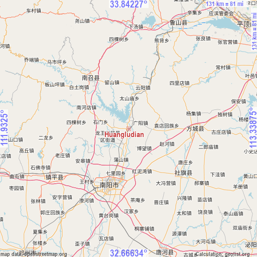
Huangludian GPS coordinates[2]
33° 15' 22.608" North, 112° 38' 8.232" East
| Map corner | latitude | longitude |
|---|---|---|
| Upper-left | 33.84227°, | 111.9325° |
| Center: | 33.25628°, | 112.63562° |
| Lower-right: | 32.66634°, | 113.33875° |
| Map W x H: | 130.8×130.8 km | = 81.3×81.3mi |
| max Lat: | 53.31946° ⇑32.8% North |
| Huangludian: | 33.25628° |
| min Lat: | ⇓67.2% South 18.22056° |
| min Long | Huangludian | max Long |
| 75.07348° | 112.63562° | 134.28917° |
| W 40.6%⇐ | ⇒59.4% E |
Elevation
Elevation of Huangludian is 155 m = 509 ft, and this is 329.8 m = 1082 ft below average elevation for this country.
| Max E: |
5622 m = 18445 ft | 51.2% |
| Avg. | 484.8 m = 1591 ft | |
| Huangludian | 155 m = 509 ft | |
Min E: |
-3 m = -10 ft | 48.8% |
See also: China elevation on elevation.city.
Geographical zone
Huangludian is located in North temperate zone (between Tropic of Cancer and the Arctic Circle). Distance of this Northern Tropic circle is 1091.8 km =678.4 mi to South.| Distance of | km | miles | from Huangludian |
|---|---|---|---|
| North Pole | 6309.3 | 3920.4 | to North |
| Arctic Circle | 3703.4 | 2301.2 | to North |
| Tropic Cancer | 1091.8 | 678.4 | to South |
| Equator | 3697.8 | 2297.7 | to South |


Nearby cities:
15 places around Huangludian: (largest is in red/bold)
• Bowang
13.7 km =8.5 mi,  131°
131°
• Guangyang
6.9 km =4.3 mi,  62°
62°
• Huanghou
27.3 km =17 mi,  24°
24°
• Liuhe
16.8 km =10.4 mi,  66°
66°
• Liushan
25.6 km =15.9 mi,  341°
341°
• Longxing
22.3 km =13.9 mi,  252°
252°
• Pushan
15.7 km =9.8 mi,  194°
194°
• Qinghe
25.1 km =15.6 mi,  91°
91°
• Shimen
14.5 km =9 mi,  284°
284°
• Sikeshu
26.9 km =16.7 mi, 277°
• Taishanmiao
15.6 km =9.7 mi,  2°
2°
• Xiezhuang
22.1 km =13.7 mi,  237°
237°
• Yuandianhui
19.5 km =12.1 mi,  84°
84°
• Yunyang
22.5 km =14 mi, 18°
• Zhaohe
20.9 km =13 mi,  111°
111°
Sources, notices
• [Note1] Compared only with cities in China existing in our database
• [Src1] Map data: © OpenStreetMap contributors (CC-BY-SA)
• [Src2] Other city data from geonames.org with taken over terms of usage.
• [Src3] Geographical zone / Annual Mean Temperature by Robert A. Rohde @ Wikipedia
