Huangjin Yaozuxiang geodata
Huangjin Yaozuxiang (Hunan) is a populated place; located in China in Asia/Shanghai (GMT+8) time zone. With population of 840 people, there are 1209 cities with bigger population in this country. Compared to other cities in China, 80.7% of cities are located further ↑North; 68.8% of cities are located further →East and 85.1% of cities have lower elevation than Huangjin Yaozuxiang. Note1


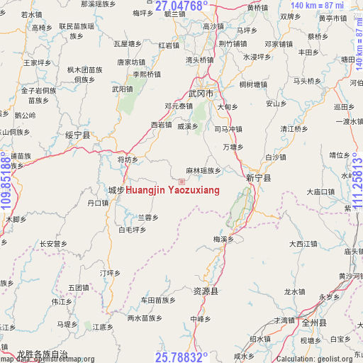
Huangjin Yaozuxiang GPS coordinates[2]
26° 25' 10.992" North, 110° 33' 18" East
| Map corner | latitude | longitude |
|---|---|---|
| Upper-left | 27.04768°, | 109.85188° |
| Center: | 26.41972°, | 110.555° |
| Lower-right: | 25.78832°, | 111.25813° |
| Map W x H: | 140×140 km | = 87×87mi |
| max Lat: | 53.31946° ⇑80.7% North |
| Huangjin Yaozuxiang: | 26.41972° |
| min Lat: | ⇓19.3% South 18.22056° |
| min Long | Huangjin Yaozux | max Long |
| 75.07348° | 110.555° | 134.28917° |
| W 31.2%⇐ | ⇒68.8% E |
Elevation
Elevation of Huangjin Yaozuxiang is 986 m = 3235 ft, and this is 501.2 m = 1644 ft above average elevation for this country.
| Max E: |
5622 m = 18445 ft | 14.9% |
| Huangjin Yaozuxiang | 986 m 3235 ft | |
| Avg. | 484.8 m = 1591 ft | |
Min E: |
-3 m = -10 ft | 85.1% |
See also: China elevation on elevation.city.
Geographical zone
Huangjin Yaozuxiang is located in North temperate zone (between Tropic of Cancer and the Arctic Circle). Distance of this Northern Tropic circle is 331.7 km =206.1 mi to South.| Distance of | km | miles | from Huangjin Yaozuxiang |
|---|---|---|---|
| North Pole | 7069.5 | 4392.8 | to North |
| Arctic Circle | 4463.6 | 2773.6 | to North |
| Tropic Cancer | 331.7 | 206.1 | to South |
| Equator | 2937.6 | 1825.3 | to South |


Nearby cities:
15 places around Huangjin Yaozuxiang: (largest is in red/bold)
• Baimaoping
25.9 km =16.1 mi,  227°
227°
• Baisha
39.1 km =24.3 mi,  73°
73°
• Dankou
31.8 km =19.8 mi,  257°
257°
• Dengyuantai
29.9 km =18.6 mi,  357°
357°
• Guanxia Miaozuxiang
32.5 km =20.2 mi,  301°
301°
• Jiangfang
22.7 km =14.1 mi,  293°
293°
• Jinshi
24.4 km =15.2 mi,  90°
90°
• Langshan
26.2 km =16.3 mi,  99°
99°
• Malin
9.5 km =5.9 mi, 65°
• Maoping
18.1 km =11.2 mi,  307°
307°
• Qingxi
20 km =12.4 mi,  273°
273°
• Rulin
29.9 km =18.6 mi,  254°
254°
• Wantang
24.1 km =15 mi,  56°
56°
• Xiyan
23.3 km =14.5 mi,  339°
339°
• Yaoshi
27.3 km =17 mi,  121°
121°
Sources, notices
• [Note1] Compared only with cities in China existing in our database
• [Src1] Map data: © OpenStreetMap contributors (CC-BY-SA)
• [Src2] Other city data from geonames.org with taken over terms of usage.
• [Src3] Geographical zone / Annual Mean Temperature by Robert A. Rohde @ Wikipedia
