Dengyuantai geodata
Dengyuantai (Hunan) is a populated place; located in China in Asia/Shanghai (GMT+8) time zone. With population of 2,190 people, there are 1012 cities with bigger population in this country. Compared to other cities in China, 79.8% of cities are located further ↑North; 68.9% of cities are located further →East and 66.8% of cities have lower elevation than Dengyuantai. Note1


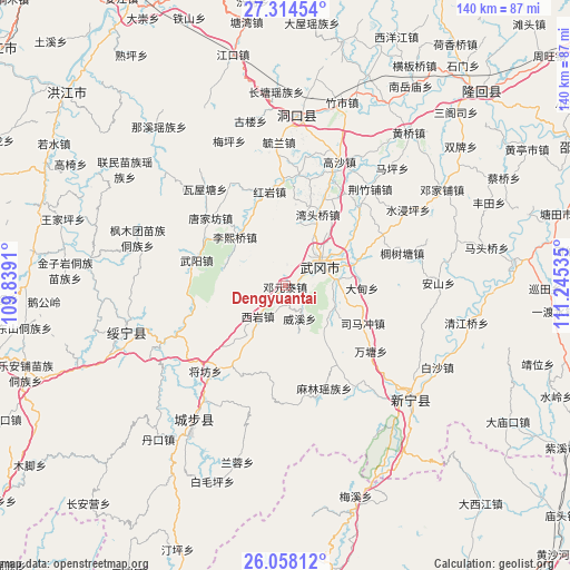
Dengyuantai GPS coordinates[2]
26° 41' 17.016" North, 110° 32' 31.992" East
| Map corner | latitude | longitude |
|---|---|---|
| Upper-left | 27.31454°, | 109.8391° |
| Center: | 26.68806°, | 110.54222° |
| Lower-right: | 26.05812°, | 111.24535° |
| Map W x H: | 139.7×139.7 km | = 86.8×86.8mi |
| max Lat: | 53.31946° ⇑79.8% North |
| Dengyuantai: | 26.68806° |
| min Lat: | ⇓20.2% South 18.22056° |
| min Long | Dengyuantai | max Long |
| 75.07348° | 110.54222° | 134.28917° |
| W 31.1%⇐ | ⇒68.9% E |
Elevation
Elevation of Dengyuantai is 356 m = 1168 ft, and this is 128.8 m = 423 ft below average elevation for this country.
| Max E: |
5622 m = 18445 ft | 33.2% |
| Avg. | 484.8 m = 1591 ft | |
| Dengyuantai | 356 m = 1168 ft | |
Min E: |
-3 m = -10 ft | 66.8% |
See also: China elevation on elevation.city.
Geographical zone
Dengyuantai is located in North temperate zone (between Tropic of Cancer and the Arctic Circle). Distance of this Northern Tropic circle is 361.5 km =224.6 mi to South.| Distance of | km | miles | from Dengyuantai |
|---|---|---|---|
| North Pole | 7039.6 | 4374.2 | to North |
| Arctic Circle | 4433.7 | 2755 | to North |
| Tropic Cancer | 361.5 | 224.6 | to South |
| Equator | 2967.4 | 1843.9 | to South |


Nearby cities:
15 places around Dengyuantai: (largest is in red/bold)
• Gaoqiao
36.1 km =22.4 mi,  99°
99°
• Guanxia Miaozuxiang
29.4 km =18.3 mi,  244°
244°
• Huangjin Yaozuxiang
29.9 km =18.6 mi,  177°
177°
• Huangtukuang
28.6 km =17.8 mi,  332°
332°
• Huayuan
25.1 km =15.6 mi,  358°
358°
• Jiangfang
28.4 km =17.6 mi,  223°
223°
• Lixiqiao
17.1 km =10.6 mi,  313°
313°
• Malin
27.7 km =17.2 mi,  159°
159°
• Maoping
22.8 km =14.2 mi,  214°
214°
• Qingxi
34.1 km =21.2 mi, 213°
• Tangjiafang
24.4 km =15.2 mi, 313°
• Wantang
26.9 km =16.7 mi,  127°
127°
• Wantouqiao
18.7 km =11.6 mi,  24°
24°
• Wuyang
22.1 km =13.7 mi,  285°
285°
• Xiyan
10.5 km =6.5 mi, 220°
Sources, notices
• [Note1] Compared only with cities in China existing in our database
• [Src1] Map data: © OpenStreetMap contributors (CC-BY-SA)
• [Src2] Other city data from geonames.org with taken over terms of usage.
• [Src3] Geographical zone / Annual Mean Temperature by Robert A. Rohde @ Wikipedia
