Baisha geodata
Baisha (Hunan) is a populated place; located in China in Asia/Shanghai (GMT+8) time zone. With population of 2,880 people, there are 958 cities with bigger population in this country. Compared to other cities in China, 80.4% of cities are located further ↑North; 67.3% of cities are located further →East and 63% of cities have lower elevation than Baisha. Note1


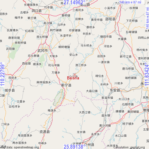
Baisha GPS coordinates[2]
26° 31' 19.992" North, 110° 55' 51.996" East
| Map corner | latitude | longitude |
|---|---|---|
| Upper-left | 27.14962°, | 110.22799° |
| Center: | 26.52222°, | 110.93111° |
| Lower-right: | 25.89138°, | 111.63424° |
| Map W x H: | 139.9×139.9 km | = 86.9×86.9mi |
| max Lat: | 53.31946° ⇑80.4% North |
| Baisha: | 26.52222° |
| min Lat: | ⇓19.6% South 18.22056° |
| min Long | Baisha | max Long |
| 75.07348° | 110.93111° | 134.28917° |
| W 32.7%⇐ | ⇒67.3% E |
Elevation
Elevation of Baisha is 296 m = 971 ft, and this is 188.8 m = 619 ft below average elevation for this country.
| Max E: |
5622 m = 18445 ft | 37% |
| Avg. | 484.8 m = 1591 ft | |
| Baisha | 296 m = 971 ft | |
Min E: |
-3 m = -10 ft | 63% |
See also: China elevation on elevation.city.
Geographical zone
Baisha is located in North temperate zone (between Tropic of Cancer and the Arctic Circle). Distance of this Northern Tropic circle is 343.1 km =213.2 mi to South.| Distance of | km | miles | from Baisha |
|---|---|---|---|
| North Pole | 7058.1 | 4385.7 | to North |
| Arctic Circle | 4452.2 | 2766.5 | to North |
| Tropic Cancer | 343.1 | 213.2 | to South |
| Equator | 2949 | 1832.4 | to South |


Nearby cities:
15 places around Baisha: (largest is in red/bold)
• Baiyashi
36.1 km =22.4 mi,  114°
114°
• Dengjiapu
42.5 km =26.4 mi,  358°
358°
• Dengyuantai
42.8 km =26.6 mi,  295°
295°
• Gaoqiao
12.8 km =8 mi,  345°
345°
• Huangjin Yaozuxiang
39.1 km =24.3 mi,  253°
253°
• Huanglong
2.2 km =1.4 mi,  8°
8°
• Jinshi
17.4 km =10.8 mi,  228°
228°
• Langshan
19.5 km =12.1 mi,  216°
216°
• Malin
29.8 km =18.5 mi,  255°
255°
• Maoping
51.7 km =32.1 mi,  269°
269°
• Qingjiangqiao
10.6 km =6.6 mi,  30°
30°
• Wantang
17.5 km =10.9 mi,  276°
276°
• Wantouqiao
47.1 km =29.3 mi,  318°
318°
• Xiyan
46.7 km =29 mi, 282°
• Yaoshi
29.1 km =18.1 mi,  209°
209°
Sources, notices
• [Note1] Compared only with cities in China existing in our database
• [Src1] Map data: © OpenStreetMap contributors (CC-BY-SA)
• [Src2] Other city data from geonames.org with taken over terms of usage.
• [Src3] Geographical zone / Annual Mean Temperature by Robert A. Rohde @ Wikipedia
