Dankou geodata
Dankou (Hunan) is a populated place; located in China in Asia/Shanghai (GMT+8) time zone. With population of 690 people, there are 1235 cities with bigger population in this country. Compared to other cities in China, 81% of cities are located further ↑North; 70.2% of cities are located further →East and 71.2% of cities have lower elevation than Dankou. Note1


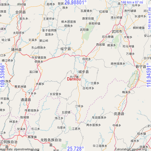
Dankou GPS coordinates[2]
26° 21' 34.992" North, 110° 14' 34.008" East
| Map corner | latitude | longitude |
|---|---|---|
| Upper-left | 26.98801°, | 109.53966° |
| Center: | 26.35972°, | 110.24278° |
| Lower-right: | 25.728°, | 110.94591° |
| Map W x H: | 140.1×140.1 km | = 87.1×87.1mi |
| max Lat: | 53.31946° ⇑81% North |
| Dankou: | 26.35972° |
| min Lat: | ⇓19% South 18.22056° |
| min Long | Dankou | max Long |
| 75.07348° | 110.24278° | 134.28917° |
| W 29.8%⇐ | ⇒70.2% E |
Elevation
Elevation of Dankou is 435 m = 1427 ft, and this is 49.8 m = 163 ft below average elevation for this country.
| Max E: |
5622 m = 18445 ft | 28.8% |
| Avg. | 484.8 m = 1591 ft | |
| Dankou | 435 m = 1427 ft | |
Min E: |
-3 m = -10 ft | 71.2% |
See also: China elevation on elevation.city.
Geographical zone
Dankou is located in North temperate zone (between Tropic of Cancer and the Arctic Circle). Distance of this Northern Tropic circle is 325 km =201.9 mi to South.| Distance of | km | miles | from Dankou |
|---|---|---|---|
| North Pole | 7076.1 | 4396.9 | to North |
| Arctic Circle | 4470.2 | 2777.7 | to North |
| Tropic Cancer | 325 | 201.9 | to South |
| Equator | 2930.9 | 1821.2 | to South |


Nearby cities:
15 places around Dankou: (largest is in red/bold)
• Baimaoping
16.2 km =10.1 mi,  132°
132°
• Changpu
27.5 km =17.1 mi,  330°
330°
• Chang’anying
18.6 km =11.6 mi,  235°
235°
• Guanxia Miaozuxiang
23.9 km =14.9 mi,  8°
8°
• Huangjin Yaozuxiang
31.8 km =19.8 mi,  77°
77°
• Jiangfang
18.8 km =11.7 mi,  33°
33°
• Jiangtousi
26.4 km =16.4 mi,  195°
195°
• Le’anpu Miaozudongzuxiang
37 km =23 mi,  293°
293°
• Linkou
39.8 km =24.7 mi,  251°
251°
• Maoping
24.5 km =15.2 mi,  43°
43°
• Qingxi
13.7 km =8.5 mi,  54°
54°
• Rulin
2.7 km =1.7 mi,  121°
121°
• Xiyan
36.6 km =22.7 mi, 38°
• Zhaishi Miaozu Dongzuxiang
25.2 km =15.7 mi,  308°
308°
• Zhuzhoujiang Miaozuxiang
39 km =24.2 mi, 334°
Sources, notices
• [Note1] Compared only with cities in China existing in our database
• [Src1] Map data: © OpenStreetMap contributors (CC-BY-SA)
• [Src2] Other city data from geonames.org with taken over terms of usage.
• [Src3] Geographical zone / Annual Mean Temperature by Robert A. Rohde @ Wikipedia
