Hongling geodata
Hongling (Guangdong) is a seat of a fourth-order administrative division; located in China in Asia/Shanghai (GMT+8) time zone. In our database, there are 1268 cities with bigger population. Compared to other cities in China, 88.6% of cities are located further ↑North; 51.7% of cities are located further →East and 68.6% of cities have lower elevation than Hongling. Note1


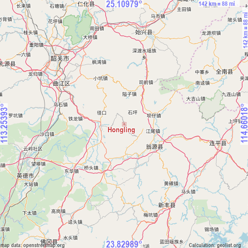
Hongling GPS coordinates[2]
24° 28' 17.292" North, 113° 57' 25.38" East
| Map corner | latitude | longitude |
|---|---|---|
| Upper-left | 25.10979°, | 113.25393° |
| Center: | 24.47147°, | 113.95705° |
| Lower-right: | 23.82989°, | 114.66018° |
| Map W x H: | 142.3×142.3 km | = 88.4×88.4mi |
| max Lat: | 53.31946° ⇑88.6% North |
| Hongling: | 24.47147° |
| min Lat: | ⇓11.4% South 18.22056° |
| min Long | Hongling | max Long |
| 75.07348° | 113.95705° | 134.28917° |
| W 48.3%⇐ | ⇒51.7% E |
Elevation
Elevation of Hongling is 387 m = 1270 ft, and this is 97.8 m = 321 ft below average elevation for this country.
| Max E: |
5622 m = 18445 ft | 31.4% |
| Avg. | 484.8 m = 1591 ft | |
| Hongling | 387 m = 1270 ft | |
Min E: |
-3 m = -10 ft | 68.6% |
See also: China elevation on elevation.city.
Geographical zone
Hongling is located in North temperate zone (between Tropic of Cancer and the Arctic Circle). Distance of this Northern Tropic circle is 115.1 km =71.5 mi to South.| Distance of | km | miles | from Hongling |
|---|---|---|---|
| North Pole | 7286.1 | 4527.4 | to North |
| Arctic Circle | 4680.2 | 2908.1 | to North |
| Tropic Cancer | 115.1 | 71.5 | to South |
| Equator | 2721 | 1690.8 | to South |


Nearby cities:
15 places around Hongling: (largest is in red/bold)
• Aizi
16.6 km =10.3 mi,  11°
11°
• Bazi
16.9 km =10.5 mi,  72°
72°
• Guandu
22.2 km =13.8 mi,  199°
199°
• Hengshishui
20.4 km =12.7 mi,  230°
230°
• Jiangwei
17.7 km =11 mi,  104°
104°
• Liuli
17.8 km =11.1 mi,  177°
177°
• Longxian
22.9 km =14.2 mi,  127°
127°
• Miaodun
25.5 km =15.8 mi,  190°
190°
• Qiaotou
30.7 km =19.1 mi,  217°
217°
• Qingtang
30.7 km =19.1 mi, 201°
• Siqian
25.5 km =15.8 mi,  30°
30°
• Tielong
28.2 km =17.5 mi,  276°
276°
• Wengcheng
16.9 km =10.5 mi, 231°
• Xinjiang
12.8 km =8 mi,  268°
268°
• Zhoupi
25.3 km =15.7 mi,  165°
165°
Sources, notices
• [Note1] Compared only with cities in China existing in our database
• [Src1] Map data: © OpenStreetMap contributors (CC-BY-SA)
• [Src2] Other city data from geonames.org with taken over terms of usage.
• [Src3] Geographical zone / Annual Mean Temperature by Robert A. Rohde @ Wikipedia
