Gantang geodata
Gantang (Fujian) is a populated place; located in China in Asia/Shanghai (GMT+8) time zone. With population of 2,770 people, there are 966 cities with bigger population in this country. Compared to other cities in China, 79.4% of cities are located further ↑North; 75.7% of cities are located further ←West and 83.7% of cities have lower elevation than Gantang. Note1


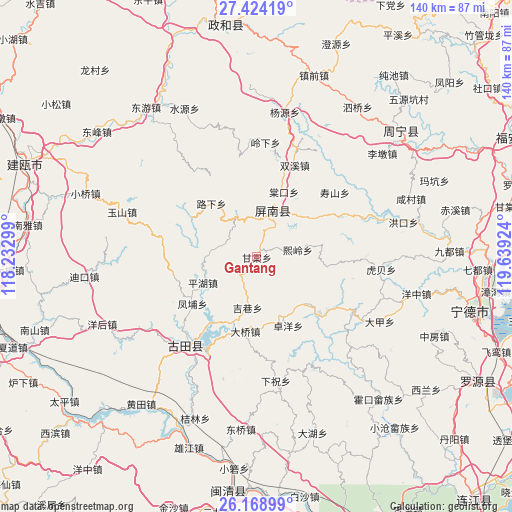
Gantang GPS coordinates[2]
26° 47' 53.988" North, 118° 56' 9.996" East
| Map corner | latitude | longitude |
|---|---|---|
| Upper-left | 27.42419°, | 118.23299° |
| Center: | 26.79833°, | 118.93611° |
| Lower-right: | 26.16899°, | 119.63924° |
| Map W x H: | 139.6×139.6 km | = 86.7×86.7mi |
| max Lat: | 53.31946° ⇑79.4% North |
| Gantang: | 26.79833° |
| min Lat: | ⇓20.6% South 18.22056° |
| min Long | Gantang | max Long |
| 75.07348° | 118.93611° | 134.28917° |
| W 75.7%⇐ | ⇒24.3% E |
Elevation
Elevation of Gantang is 895 m = 2936 ft, and this is 410.2 m = 1346 ft above average elevation for this country.
| Max E: |
5622 m = 18445 ft | 16.3% |
| Gantang | 895 m 2936 ft | |
| Avg. | 484.8 m = 1591 ft | |
Min E: |
-3 m = -10 ft | 83.7% |
See also: China elevation on elevation.city.
Geographical zone
Gantang is located in North temperate zone (between Tropic of Cancer and the Arctic Circle). Distance of this Northern Tropic circle is 373.8 km =232.3 mi to South.| Distance of | km | miles | from Gantang |
|---|---|---|---|
| North Pole | 7027.4 | 4366.6 | to North |
| Arctic Circle | 4421.5 | 2747.4 | to North |
| Tropic Cancer | 373.8 | 232.3 | to South |
| Equator | 2979.7 | 1851.5 | to South |


Nearby cities:
15 places around Gantang: (largest is in red/bold)
• Changqiao
9.5 km =5.9 mi,  285°
285°
• Daixi
17.7 km =11 mi,  84°
84°
• Daqiao
20.6 km =12.8 mi,  188°
188°
• Fengpu
21.7 km =13.5 mi,  233°
233°
• Gufeng
13 km =8.1 mi,  20°
20°
• Hengyang
24.4 km =15.2 mi,  182°
182°
• Hetang
23 km =14.3 mi,  131°
131°
• Jixiang
14.2 km =8.8 mi, 189°
• Luxia
19.4 km =12.1 mi,  318°
318°
• Pinghu
15.8 km =9.8 mi,  244°
244°
• Shoushan
29 km =18 mi,  50°
50°
• Shuangxi
27 km =16.8 mi, 22°
• Tangkou
18.9 km =11.7 mi, 23°
• Xiling
11.2 km =7 mi, 80°
• Zhuoyang
20.5 km =12.7 mi,  155°
155°
Sources, notices
• [Note1] Compared only with cities in China existing in our database
• [Src1] Map data: © OpenStreetMap contributors (CC-BY-SA)
• [Src2] Other city data from geonames.org with taken over terms of usage.
• [Src3] Geographical zone / Annual Mean Temperature by Robert A. Rohde @ Wikipedia
