Fengpu geodata
Fengpu (Fujian) is a seat of a fourth-order administrative division; located in China in Asia/Shanghai (GMT+8) time zone. With population of 3,560 people, there are 917 cities with bigger population in this country. Compared to other cities in China, 79.8% of cities are located further ↑North; 74.7% of cities are located further ←West and 69.7% of cities have lower elevation than Fengpu. Note1


Fengpu GPS coordinates[2]
26° 40' 57.936" North, 118° 45' 36.216" East
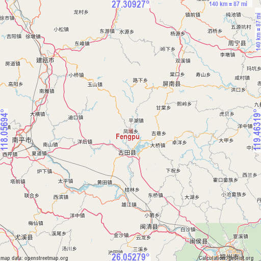
| Map corner | latitude | longitude |
|---|---|---|
| Upper-left | 27.30927°, | 118.05694° |
| Center: | 26.68276°, | 118.76006° |
| Lower-right: | 26.05279°, | 119.46319° |
| Map W x H: | 139.7×139.7 km | = 86.8×86.8mi |
| max Lat: | 53.31946° ⇑79.8% North |
| Fengpu: | 26.68276° |
| min Lat: | ⇓20.2% South 18.22056° |
| min Long | Fengpu | max Long |
| 75.07348° | 118.76006° | 134.28917° |
| W 74.7%⇐ | ⇒25.3% E |
Elevation
Elevation of Fengpu is 406 m = 1332 ft, and this is 78.8 m = 259 ft below average elevation for this country.
| Max E: |
5622 m = 18445 ft | 30.3% |
| Avg. | 484.8 m = 1591 ft | |
| Fengpu | 406 m = 1332 ft | |
Min E: |
-3 m = -10 ft | 69.7% |
See also: China elevation on elevation.city.
Geographical zone
Fengpu is located in North temperate zone (between Tropic of Cancer and the Arctic Circle). Distance of this Northern Tropic circle is 360.9 km =224.3 mi to South.| Distance of | km | miles | from Fengpu |
|---|---|---|---|
| North Pole | 7040.2 | 4374.6 | to North |
| Arctic Circle | 4434.3 | 2755.3 | to North |
| Tropic Cancer | 360.9 | 224.3 | to South |
| Equator | 2966.8 | 1843.5 | to South |


Nearby cities:
15 places around Fengpu: (largest is in red/bold)
• Changqiao
17.5 km =10.9 mi,  28°
28°
• Chengdong
11.8 km =7.3 mi,  190°
190°
• Daqiao
16.4 km =10.2 mi,  117°
117°
• Dikou
30.2 km =18.8 mi,  284°
284°
• Gantang
21.7 km =13.5 mi,  53°
53°
• Hengyang
20.2 km =12.6 mi, 124°
• Huangtian
30.3 km =18.8 mi,  206°
206°
• Jixiang
15.2 km =9.4 mi,  94°
94°
• Luxia
27.9 km =17.3 mi,  9°
9°
• Panyang
16.4 km =10.2 mi,  154°
154°
• Pinghu
6.8 km =4.2 mi, 27°
• Shuangzhu
12.7 km =7.9 mi,  243°
243°
• Songji
12 km =7.5 mi, 189°
• Yanghou
25.5 km =15.8 mi,  259°
259°
• Zhuoyang
26.6 km =16.5 mi,  102°
102°
Sources, notices
• [Note1] Compared only with cities in China existing in our database
• [Src1] Map data: © OpenStreetMap contributors (CC-BY-SA)
• [Src2] Other city data from geonames.org with taken over terms of usage.
• [Src3] Geographical zone / Annual Mean Temperature by Robert A. Rohde @ Wikipedia
