Hetang geodata
Hetang (Fujian) is a seat of a fourth-order administrative division; located in China in Asia/Shanghai (GMT+8) time zone. With population of 3,430 people, there are 926 cities with bigger population in this country. Compared to other cities in China, 79.9% of cities are located further ↑North; 76.6% of cities are located further ←West and 72.6% of cities have lower elevation than Hetang. Note1


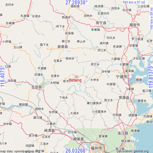
Hetang GPS coordinates[2]
26° 39' 45.936" North, 119° 6' 38.232" East
| Map corner | latitude | longitude |
|---|---|---|
| Upper-left | 27.28938°, | 118.4075° |
| Center: | 26.66276°, | 119.11062° |
| Lower-right: | 26.03268°, | 119.81375° |
| Map W x H: | 139.7×139.7 km | = 86.8×86.8mi |
| max Lat: | 53.31946° ⇑79.9% North |
| Hetang: | 26.66276° |
| min Lat: | ⇓20.1% South 18.22056° |
| min Long | Hetang | max Long |
| 75.07348° | 119.11062° | 134.28917° |
| W 76.6%⇐ | ⇒23.4% E |
Elevation
Elevation of Hetang is 466 m = 1529 ft, and this is 18.8 m = 62 ft below average elevation for this country.
| Max E: |
5622 m = 18445 ft | 27.4% |
| Avg. | 484.8 m = 1591 ft | |
| Hetang | 466 m = 1529 ft | |
Min E: |
-3 m = -10 ft | 72.6% |
See also: China elevation on elevation.city.
Geographical zone
Hetang is located in North temperate zone (between Tropic of Cancer and the Arctic Circle). Distance of this Northern Tropic circle is 358.7 km =222.9 mi to South.| Distance of | km | miles | from Hetang |
|---|---|---|---|
| North Pole | 7042.4 | 4375.9 | to North |
| Arctic Circle | 4436.6 | 2756.8 | to North |
| Tropic Cancer | 358.7 | 222.9 | to South |
| Equator | 2964.6 | 1842.1 | to South |


Nearby cities:
15 places around Hetang: (largest is in red/bold)
• Daixi
16.7 km =10.4 mi,  1°
1°
• Dajia
16.6 km =10.3 mi,  99°
99°
• Daqiao
21 km =13 mi,  255°
255°
• Gantang
23 km =14.3 mi,  311°
311°
• Gufeng
30.1 km =18.7 mi,  334°
334°
• Hengyang
20.5 km =12.7 mi,  242°
242°
• Huokou
28.7 km =17.8 mi,  145°
145°
• Jixiang
19.7 km =12.2 mi,  273°
273°
• Luoqiao
23.7 km =14.7 mi,  206°
206°
• Shanyang
9.4 km =5.8 mi,  84°
84°
• Tingping
16.8 km =10.4 mi,  199°
199°
• Xiazhu
22.3 km =13.9 mi, 212°
• Xiling
18 km =11.2 mi,  339°
339°
• Yangzhong
26.6 km =16.5 mi, 79°
• Zhuoyang
9.6 km =6 mi,  247°
247°
Sources, notices
• [Note1] Compared only with cities in China existing in our database
• [Src1] Map data: © OpenStreetMap contributors (CC-BY-SA)
• [Src2] Other city data from geonames.org with taken over terms of usage.
• [Src3] Geographical zone / Annual Mean Temperature by Robert A. Rohde @ Wikipedia
