Gangkoujie geodata
Gangkoujie (Jiangxi) is a seat of a fourth-order administrative division; located in China in Asia/Shanghai (GMT+8) time zone. In our database, there are 1268 cities with bigger population. Compared to other cities in China, 57.1% of cities are located further ↑North; 58.8% of cities are located further ←West and 84.9% of cities have higher elevation than Gangkoujie. Note1


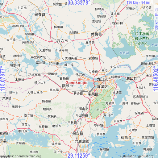
Gangkoujie GPS coordinates[2]
29° 43' 30.144" North, 115° 46' 54.804" East
| Map corner | latitude | longitude |
|---|---|---|
| Upper-left | 30.33378°, | 115.07877° |
| Center: | 29.72504°, | 115.78189° |
| Lower-right: | 29.11259°, | 116.48502° |
| Map W x H: | 135.8×135.8 km | = 84.4×84.4mi |
| max Lat: | 53.31946° ⇑57.1% North |
| Gangkoujie: | 29.72504° |
| min Lat: | ⇓42.9% South 18.22056° |
| min Long | Gangkoujie | max Long |
| 75.07348° | 115.78189° | 134.28917° |
| W 58.8%⇐ | ⇒41.2% E |
Elevation
Elevation of Gangkoujie is 16 m = 52 ft, and this is 468.8 m = 1538 ft below average elevation for this country.
| Max E: |
5622 m = 18445 ft | 84.9% |
| Avg. | 484.8 m = 1591 ft | |
| Gangkoujie | 16 m = 52 ft | |
Min E: |
-3 m = -10 ft | 15.1% |
See also: China elevation on elevation.city.
Geographical zone
Gangkoujie is located in North temperate zone (between Tropic of Cancer and the Arctic Circle). Distance of this Northern Tropic circle is 699.2 km =434.5 mi to South.| Distance of | km | miles | from Gangkoujie |
|---|---|---|---|
| North Pole | 6701.9 | 4164.4 | to North |
| Arctic Circle | 4096.1 | 2545.2 | to North |
| Tropic Cancer | 699.2 | 434.5 | to South |
| Equator | 3305.1 | 2053.7 | to South |


Nearby cities:
15 places around Gangkoujie: (largest is in red/bold)
• Baiyang
12.8 km =8 mi,  274°
274°
• Caishan
17.6 km =10.9 mi,  1°
1°
• Chengmen
9.5 km =5.9 mi,  162°
162°
• Chengzi
15.4 km =9.6 mi,  324°
324°
• Fenlu
13.6 km =8.5 mi,  58°
58°
• Longping
18 km =11.2 mi,  333°
333°
• Shahejie
16.5 km =10.3 mi,  141°
141°
• Shizi
14.6 km =9.1 mi, 158°
• Wujiao
16.1 km =10 mi,  287°
287°
• Xiaochi
20.3 km =12.6 mi,  81°
81°
• Xinhe
11.8 km =7.3 mi,  186°
186°
• Xinkai
10.1 km =6.3 mi,  15°
15°
• Xintang
13.5 km =8.4 mi,  209°
209°
• Yongquan
16.2 km =10.1 mi,  222°
222°
• Yong’an
4.5 km =2.8 mi,  9°
9°
Sources, notices
• [Note1] Compared only with cities in China existing in our database
• [Src1] Map data: © OpenStreetMap contributors (CC-BY-SA)
• [Src2] Other city data from geonames.org with taken over terms of usage.
• [Src3] Geographical zone / Annual Mean Temperature by Robert A. Rohde @ Wikipedia
