Fushanzhuang geodata
Fushanzhuang (Shanxi) is a seat of a fourth-order administrative division; located in China in Asia/Shanghai (GMT+8) time zone. In our database, there are 1268 cities with bigger population. Compared to other cities in China, 83.9% of cities are located further ↓South; 59.4% of cities are located further →East and 86.1% of cities have lower elevation than Fushanzhuang. Note1


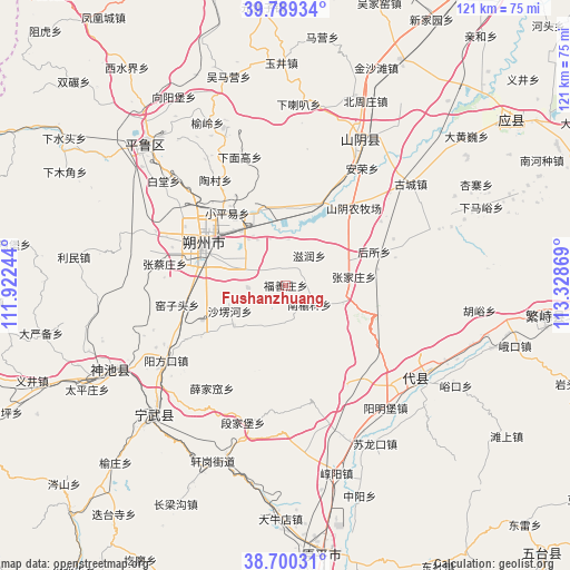
Fushanzhuang GPS coordinates[2]
39° 14' 48.984" North, 112° 37' 32.016" East
| Map corner | latitude | longitude |
|---|---|---|
| Upper-left | 39.78934°, | 111.92244° |
| Center: | 39.24694°, | 112.62556° |
| Lower-right: | 38.70031°, | 113.32869° |
| Map W x H: | 121.1×121.1 km | = 75.2×75.2mi |
| max Lat: | 53.31946° ⇑16.1% North |
| Fushanzhuang: | 39.24694° |
| min Lat: | ⇓83.9% South 18.22056° |
| min Long | Fushanzhuang | max Long |
| 75.07348° | 112.62556° | 134.28917° |
| W 40.6%⇐ | ⇒59.4% E |
Elevation
Elevation of Fushanzhuang is 1053 m = 3455 ft, and this is 568.2 m = 1864 ft above average elevation for this country.
| Max E: |
5622 m = 18445 ft | 13.9% |
| Fushanzhuang | 1053 m 3455 ft | |
| Avg. | 484.8 m = 1591 ft | |
Min E: |
-3 m = -10 ft | 86.1% |
See also: China elevation on elevation.city.
Geographical zone
Fushanzhuang is located in North temperate zone (between Tropic of Cancer and the Arctic Circle). Distance of this Northern Tropic circle is 1757.9 km =1092.3 mi to South.| Distance of | km | miles | from Fushanzhuang |
|---|---|---|---|
| North Pole | 5643.2 | 3506.5 | to North |
| Arctic Circle | 3037.3 | 1887.3 | to North |
| Tropic Cancer | 1757.9 | 1092.3 | to South |
| Equator | 4363.9 | 2711.6 | to South |


Nearby cities:
15 places around Fushanzhuang: (largest is in red/bold)
• Dongshentou
16 km =9.9 mi,  345°
345°
• Housuo
20.1 km =12.5 mi,  69°
69°
• Jiazhuang
8 km =5 mi,  266°
266°
• Nanyulinxi
6.4 km =4 mi,  131°
131°
• Shangshaleng
13 km =8.1 mi,  245°
245°
• Shuozhou
19.1 km =11.9 mi,  293°
293°
• Taocun
26.8 km =16.7 mi,  326°
326°
• Xiaopingyi
19.7 km =12.2 mi,  321°
321°
• Xiatuanpu
24.8 km =15.4 mi,  300°
300°
• Xuejiawa
27 km =16.8 mi,  215°
215°
• Xuekulue
23.2 km =14.4 mi,  39°
39°
• Yanmenguan
21.1 km =13.1 mi,  107°
107°
• Zhangcaizhuang
26.1 km =16.2 mi,  280°
280°
• Zhangjiazhuang
14.6 km =9.1 mi,  82°
82°
• Zirun
8 km =5 mi, 38°
Sources, notices
• [Note1] Compared only with cities in China existing in our database
• [Src1] Map data: © OpenStreetMap contributors (CC-BY-SA)
• [Src2] Other city data from geonames.org with taken over terms of usage.
• [Src3] Geographical zone / Annual Mean Temperature by Robert A. Rohde @ Wikipedia
