Fengyu geodata
Fengyu (Shanxi) is a seat of a fourth-order administrative division; located in China in Asia/Shanghai (GMT+8) time zone. In our database, there are 1268 cities with bigger population. Compared to other cities in China, 86.1% of cities are located further ↓South; 53.6% of cities are located further →East and 84.8% of cities have lower elevation than Fengyu. Note1


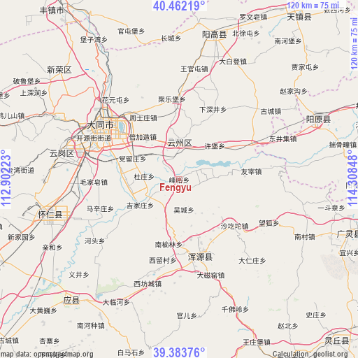
Fengyu GPS coordinates[2]
39° 55' 30.36" North, 113° 36' 19.26" East
| Map corner | latitude | longitude |
|---|---|---|
| Upper-left | 40.46219°, | 112.90223° |
| Center: | 39.9251°, | 113.60535° |
| Lower-right: | 39.38376°, | 114.30848° |
| Map W x H: | 119.9×119.9 km | = 74.5×74.5mi |
| max Lat: | 53.31946° ⇑13.9% North |
| Fengyu: | 39.9251° |
| min Lat: | ⇓86.1% South 18.22056° |
| min Long | Fengyu | max Long |
| 75.07348° | 113.60535° | 134.28917° |
| W 46.4%⇐ | ⇒53.6% E |
Elevation
Elevation of Fengyu is 970 m = 3182 ft, and this is 485.2 m = 1592 ft above average elevation for this country.
| Max E: |
5622 m = 18445 ft | 15.2% |
| Fengyu | 970 m 3182 ft | |
| Avg. | 484.8 m = 1591 ft | |
Min E: |
-3 m = -10 ft | 84.8% |
See also: China elevation on elevation.city.
Geographical zone
Fengyu is located in North temperate zone (between Tropic of Cancer and the Arctic Circle). Distance of this Northern Tropic circle is 1833.3 km =1139.2 mi to South.| Distance of | km | miles | from Fengyu |
|---|---|---|---|
| North Pole | 5567.8 | 3459.7 | to North |
| Arctic Circle | 2961.9 | 1840.4 | to North |
| Tropic Cancer | 1833.3 | 1139.2 | to South |
| Equator | 4439.3 | 2758.5 | to South |


Nearby cities:
15 places around Fengyu: (largest is in red/bold)
• Beijiazao
18.4 km =11.4 mi,  320°
320°
• Caicun
20.5 km =12.7 mi,  169°
169°
• Dangliuzhuang
17.1 km =10.6 mi,  294°
294°
• Duzhuang
11.8 km =7.3 mi,  275°
275°
• Guayuan
11.4 km =7.1 mi,  20°
20°
• Jijiazhuang
15.4 km =9.6 mi,  236°
236°
• Jule
26.8 km =16.7 mi,  354°
354°
• Nanyulin
20.7 km =12.9 mi,  189°
189°
• Wucheng
10.2 km =6.3 mi, 171°
• Xiahan
22.3 km =13.9 mi,  178°
178°
• Xiping
12.7 km =7.9 mi,  359°
359°
• Xubu
16.5 km =10.3 mi,  46°
46°
• Yong’an
26.4 km =16.4 mi,  164°
164°
• Youzai
24.3 km =15.1 mi,  83°
83°
• Zhoushizhuang
24.1 km =15 mi,  330°
330°
Sources, notices
• [Note1] Compared only with cities in China existing in our database
• [Src1] Map data: © OpenStreetMap contributors (CC-BY-SA)
• [Src2] Other city data from geonames.org with taken over terms of usage.
• [Src3] Geographical zone / Annual Mean Temperature by Robert A. Rohde @ Wikipedia
