Longshanqiao geodata
Longshanqiao (Anhui) is a seat of a fourth-order administrative division; located in China in Asia/Shanghai (GMT+8) time zone. In our database, there are 1268 cities with bigger population. Compared to other cities in China, 58.4% of cities are located further ↓South; 73.1% of cities are located further ←West and 87.7% of cities have higher elevation than Longshanqiao. Note1


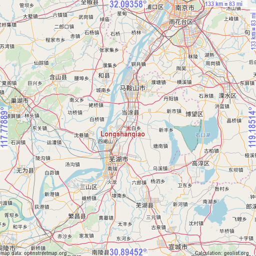
Longshanqiao GPS coordinates[2]
31° 29' 45.492" North, 118° 28' 55.236" East
| Map corner | latitude | longitude |
|---|---|---|
| Upper-left | 32.09358°, | 117.77889° |
| Center: | 31.49597°, | 118.48201° |
| Lower-right: | 30.89452°, | 119.18514° |
| Map W x H: | 133.3×133.3 km | = 82.8×82.8mi |
| max Lat: | 53.31946° ⇑41.6% North |
| Longshanqiao: | 31.49597° |
| min Lat: | ⇓58.4% South 18.22056° |
| min Long | Longshanqiao | max Long |
| 75.07348° | 118.48201° | 134.28917° |
| W 73.1%⇐ | ⇒26.9% E |
Elevation
Elevation of Longshanqiao is 12 m = 39 ft, and this is 472.8 m = 1551 ft below average elevation for this country.
| Max E: |
5622 m = 18445 ft | 87.7% |
| Avg. | 484.8 m = 1591 ft | |
| Longshanqiao | 12 m = 39 ft | |
Min E: |
-3 m = -10 ft | 12.3% |
See also: China elevation on elevation.city.
Geographical zone
Longshanqiao is located in North temperate zone (between Tropic of Cancer and the Arctic Circle). Distance of this Northern Tropic circle is 896.1 km =556.8 mi to South.| Distance of | km | miles | from Longshanqiao |
|---|---|---|---|
| North Pole | 6505 | 4042 | to North |
| Arctic Circle | 3899.2 | 2422.8 | to North |
| Tropic Cancer | 896.1 | 556.8 | to South |
| Equator | 3502 | 2176 | to South |


Nearby cities:
15 places around Longshanqiao: (largest is in red/bold)
• Baiqiao
17.1 km =10.6 mi,  285°
285°
• Daqiao
7.8 km =4.8 mi,  243°
243°
• Dazha
13.5 km =8.4 mi,  166°
166°
• Dongjiang Matoukou
11.6 km =7.2 mi,  346°
346°
• Guandou
15.3 km =9.5 mi,  211°
211°
• Gushu
7.2 km =4.5 mi,  359°
359°
• Huhe
10.3 km =6.4 mi,  80°
80°
• Maqiao
15.1 km =9.4 mi,  130°
130°
• Niandou
7.2 km =4.5 mi,  197°
197°
• Shiqiao
12.7 km =7.9 mi,  118°
118°
• Taibai
2.7 km =1.7 mi,  85°
85°
• Wanli
14.1 km =8.8 mi,  218°
218°
• Xiheshan
13.9 km =8.6 mi, 244°
• Xinqiao
3.4 km =2.1 mi,  301°
301°
• Yintang
12.6 km =7.8 mi,  20°
20°
Sources, notices
• [Note1] Compared only with cities in China existing in our database
• [Src1] Map data: © OpenStreetMap contributors (CC-BY-SA)
• [Src2] Other city data from geonames.org with taken over terms of usage.
• [Src3] Geographical zone / Annual Mean Temperature by Robert A. Rohde @ Wikipedia
