Yintang geodata
Yintang (Anhui) is a seat of a fourth-order administrative division; located in China in Asia/Shanghai (GMT+8) time zone. In our database, there are 1268 cities with bigger population. Compared to other cities in China, 59% of cities are located further ↓South; 73.4% of cities are located further ←West and 82.9% of cities have higher elevation than Yintang. Note1


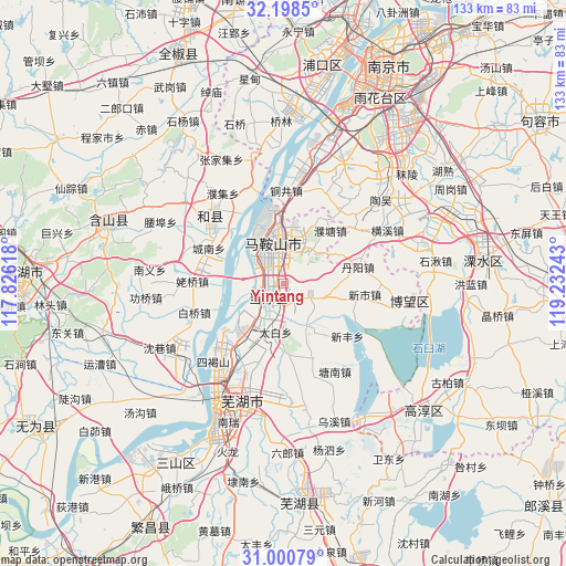
Yintang GPS coordinates[2]
31° 36' 5.652" North, 118° 31' 45.48" East
| Map corner | latitude | longitude |
|---|---|---|
| Upper-left | 32.1985°, | 117.82618° |
| Center: | 31.60157°, | 118.5293° |
| Lower-right: | 31.00079°, | 119.23243° |
| Map W x H: | 133.2×133.2 km | = 82.8×82.8mi |
| max Lat: | 53.31946° ⇑41% North |
| Yintang: | 31.60157° |
| min Lat: | ⇓59% South 18.22056° |
| min Long | Yintang | max Long |
| 75.07348° | 118.5293° | 134.28917° |
| W 73.4%⇐ | ⇒26.6% E |
Elevation
Elevation of Yintang is 20 m = 66 ft, and this is 464.8 m = 1525 ft below average elevation for this country.
| Max E: |
5622 m = 18445 ft | 82.9% |
| Avg. | 484.8 m = 1591 ft | |
| Yintang | 20 m = 66 ft | |
Min E: |
-3 m = -10 ft | 17.1% |
See also: China elevation on elevation.city.
Geographical zone
Yintang is located in North temperate zone (between Tropic of Cancer and the Arctic Circle). Distance of this Northern Tropic circle is 907.8 km =564.1 mi to South.| Distance of | km | miles | from Yintang |
|---|---|---|---|
| North Pole | 6493.3 | 4034.7 | to North |
| Arctic Circle | 3887.4 | 2415.5 | to North |
| Tropic Cancer | 907.8 | 564.1 | to South |
| Equator | 3513.8 | 2183.4 | to South |


Nearby cities:
15 places around Yintang: (largest is in red/bold)
• Caishi
8.2 km =5.1 mi,  309°
309°
• Dongjiang Matoukou
7.2 km =4.5 mi,  266°
266°
• Gushu
6.4 km =4 mi,  224°
224°
• Huhe
11.6 km =7.2 mi,  150°
150°
• Huoli
11.2 km =7 mi,  23°
23°
• Jiefanglu
12.1 km =7.5 mi,  350°
350°
• Jinjiazhuang
13.7 km =8.5 mi,  344°
344°
• Liu‘an
5.8 km =3.6 mi, 354°
• Longshanqiao
12.6 km =7.8 mi,  200°
200°
• Ma’anshan
9.5 km =5.9 mi, 349°
• Taibai
11.7 km =7.3 mi,  188°
188°
• Xiangshan
8.5 km =5.3 mi,  39°
39°
• Xinqiao
12.4 km =7.7 mi, 216°
• Xuejin
11.1 km =6.9 mi,  104°
104°
• Yushan
9 km =5.6 mi,  331°
331°
Sources, notices
• [Note1] Compared only with cities in China existing in our database
• [Src1] Map data: © OpenStreetMap contributors (CC-BY-SA)
• [Src2] Other city data from geonames.org with taken over terms of usage.
• [Src3] Geographical zone / Annual Mean Temperature by Robert A. Rohde @ Wikipedia
