Chengyang geodata
Chengyang (Shandong) is a seat of a third-order administrative division; located in China in Asia/Shanghai (GMT+8) time zone. In our database, there are 1268 cities with bigger population. Compared to other cities in China, 77.8% of cities are located further ↓South; 84.3% of cities are located further ←West and 86.9% of cities have higher elevation than Chengyang. Note1


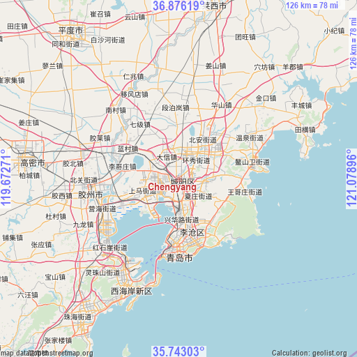
Chengyang GPS coordinates[2]
36° 18' 42.012" North, 120° 22' 32.988" East
| Map corner | latitude | longitude |
|---|---|---|
| Upper-left | 36.87619°, | 119.67271° |
| Center: | 36.31167°, | 120.37583° |
| Lower-right: | 35.74303°, | 121.07896° |
| Map W x H: | 126×126 km | = 78.3×78.3mi |
| max Lat: | 53.31946° ⇑22.2% North |
| Chengyang: | 36.31167° |
| min Lat: | ⇓77.8% South 18.22056° |
| min Long | Chengyang | max Long |
| 75.07348° | 120.37583° | 134.28917° |
| W 84.3%⇐ | ⇒15.7% E |
Elevation
Elevation of Chengyang is 13 m = 43 ft, and this is 471.8 m = 1548 ft below average elevation for this country.
| Max E: |
5622 m = 18445 ft | 86.9% |
| Avg. | 484.8 m = 1591 ft | |
| Chengyang | 13 m = 43 ft | |
Min E: |
-3 m = -10 ft | 13.1% |
See also: China elevation on elevation.city.
Geographical zone
Chengyang is located in North temperate zone (between Tropic of Cancer and the Arctic Circle). Distance of this Northern Tropic circle is 1431.6 km =889.6 mi to South.| Distance of | km | miles | from Chengyang |
|---|---|---|---|
| North Pole | 5969.6 | 3709.3 | to North |
| Arctic Circle | 3363.7 | 2090.1 | to North |
| Tropic Cancer | 1431.6 | 889.6 | to South |
| Equator | 4037.5 | 2508.8 | to South |


Nearby cities:
15 places around Chengyang: (largest is in red/bold)
• Beizhai
17.1 km =10.6 mi,  126°
126°
• Changjianglu Jiedao
42.5 km =26.4 mi,  205°
205°
• Dengying
26.2 km =16.3 mi,  137°
137°
• Gaomi
56.4 km =35 mi,  278°
278°
• Jiaozhou
33.5 km =20.8 mi,  264°
264°
• Jimo
11.6 km =7.2 mi,  41°
41°
• Kutao
21.1 km =13.1 mi,  151°
151°
• Laixi
62.4 km =38.8 mi,  12°
12°
• Nanshu
78.8 km =49 mi,  357°
357°
• Pingdu
65.1 km =40.5 mi,  323°
323°
• Qingdao
27.4 km =17 mi,  179°
179°
• Qingshancun
32.6 km =20.3 mi,  122°
122°
• Shazikou
26.2 km =16.3 mi, 146°
• Shilaorencun
25.9 km =16.1 mi,  156°
156°
• Yinzhu
60.1 km =37.3 mi,  216°
216°
Sources, notices
• [Note1] Compared only with cities in China existing in our database
• [Src1] Map data: © OpenStreetMap contributors (CC-BY-SA)
• [Src2] Other city data from geonames.org with taken over terms of usage.
• [Src3] Geographical zone / Annual Mean Temperature by Robert A. Rohde @ Wikipedia
