Chengjia geodata
Chengjia (Guangdong) is a seat of a fourth-order administrative division; located in China in Asia/Shanghai (GMT+8) time zone. In our database, there are 1268 cities with bigger population. Compared to other cities in China, 87.3% of cities are located further ↑North; 58.7% of cities are located further →East and 59.7% of cities have higher elevation than Chengjia. Note1


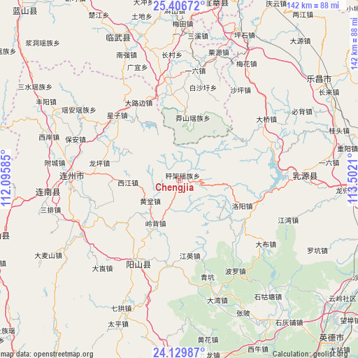
Chengjia GPS coordinates[2]
24° 46' 11.784" North, 112° 47' 56.292" East
| Map corner | latitude | longitude |
|---|---|---|
| Upper-left | 25.40672°, | 112.09585° |
| Center: | 24.76994°, | 112.79897° |
| Lower-right: | 24.12987°, | 113.5021° |
| Map W x H: | 142×142 km | = 88.2×88.2mi |
| max Lat: | 53.31946° ⇑87.3% North |
| Chengjia: | 24.76994° |
| min Lat: | ⇓12.7% South 18.22056° |
| min Long | Chengjia | max Long |
| 75.07348° | 112.79897° | 134.28917° |
| W 41.3%⇐ | ⇒58.7% E |
Elevation
Elevation of Chengjia is 100 m = 328 ft, and this is 384.8 m = 1262 ft below average elevation for this country.
| Max E: |
5622 m = 18445 ft | 59.7% |
| Avg. | 484.8 m = 1591 ft | |
| Chengjia | 100 m = 328 ft | |
Min E: |
-3 m = -10 ft | 40.3% |
See also: China elevation on elevation.city.
Geographical zone
Chengjia is located in North temperate zone (between Tropic of Cancer and the Arctic Circle). Distance of this Northern Tropic circle is 148.2 km =92.1 mi to South.| Distance of | km | miles | from Chengjia |
|---|---|---|---|
| North Pole | 7252.9 | 4506.7 | to North |
| Arctic Circle | 4647 | 2887.5 | to North |
| Tropic Cancer | 148.2 | 92.1 | to South |
| Equator | 2754.2 | 1711.4 | to South |


Nearby cities:
15 places around Chengjia: (largest is in red/bold)
• Dalubian
33.9 km =21.1 mi,  327°
327°
• Daqiao
41.2 km =25.6 mi,  54°
54°
• Dongping
39.4 km =24.5 mi,  94°
94°
• Huangben
14.4 km =8.9 mi,  233°
233°
• Jiangying
30.5 km =19 mi,  172°
172°
• Lingbei
19.8 km =12.3 mi,  209°
209°
• Longping
32.9 km =20.4 mi,  279°
279°
• Luoyang
26.7 km =16.6 mi,  112°
112°
• Qingkeng
40.4 km =25.1 mi,  164°
164°
• Qinglian
34.3 km =21.3 mi,  187°
187°
• Shantang
39.5 km =24.5 mi, 329°
• Xiaojiang
26.9 km =16.7 mi, 230°
• Xijiang
21.8 km =13.5 mi,  265°
265°
• Xingzi
35.8 km =22.2 mi,  315°
315°
• Yangcheng
36 km =22.4 mi, 206°
Sources, notices
• [Note1] Compared only with cities in China existing in our database
• [Src1] Map data: © OpenStreetMap contributors (CC-BY-SA)
• [Src2] Other city data from geonames.org with taken over terms of usage.
• [Src3] Geographical zone / Annual Mean Temperature by Robert A. Rohde @ Wikipedia
